Map of Syracuse, New York
Our Syracuse map highlights this upstate city. Syracuse University, a historic downtown, and snow-filled winters define the area.
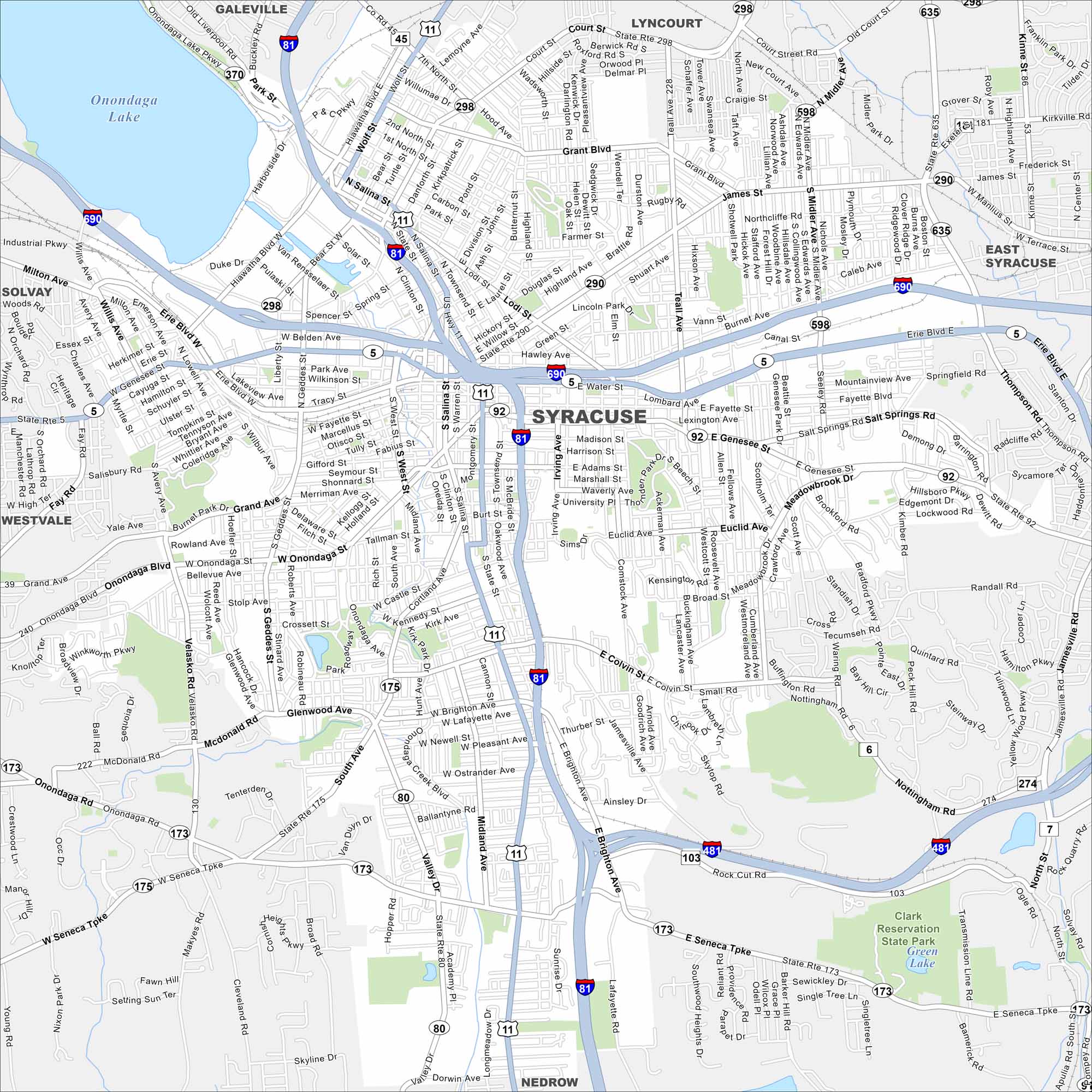
Map Information
On the Map
Interstates/Highways: I-81, I-690, I-481, US Hwy 11, State Rte 5, State Rte 92, State Rte 298, State Rte 290, State Rte 598, State Rte 635, State Rte 175, State Rte 173, State Rte 80 Major Roads: James St, Erie Blvd, Genesee St, Salina St, Onondaga Blvd, Colvin St, Brighton Ave, Seneca Tpke, Park St, Court St, Hiawatha Blvd, Bear St, Spencer St, West St, Clinton St, Townsend St, Lodi St, Teall Ave, Burnet Ave, Midler Ave Lakes and Reservoirs: Onondaga Lake, Green Lake Parks and Preserves: Clark Reservation State Park Nearby Communities: Galeville, Lyncourt, East Syracuse, Nedrow, Onondaga Hill, Westvale, SolvayNew York State Maps
Find state maps of the Empire State.


City Maps of New York
Here are the city maps that define New York


