Map of Tamarac, Florida
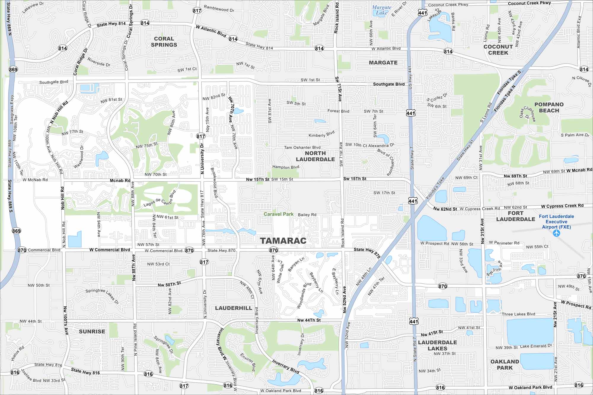
Looking for a map of Tamarac? This Broward County suburb has golf courses, quiet neighborhoods, and easy access to Fort Lauderdale.
Florida State Maps
Discover Florida through our state maps


Map Information
On the Map
Interstates/Highways: State Hwy 869, State Hwy 814, State Hwy 817, State Hwy 870, US Hwy 441 Major Roads: University Dr, Commercial Blvd, Pine Island Rd, Rock Island Rd, Nob Hill Dr, McNab Rd, Atlantic Blvd, NW 88th Ave, NW 70th Ave, NW 31st Ave, Riverside Dr, Southgate Blvd, Coconut Creek Pkwy, NW 57th St, NW 82nd Ave, NW 100th Ave, Hiatus Rd Airports: Fort Lauderdale Executive Airport (FXE) Lakes and Reservoirs: Margate Lake Nearby Communities: Coral Springs, Margate, Coconut Creek, Pompano Beach, North Lauderdale, Lauderdale Lakes, Lauderhill, SunriseFlorida City Maps
Chart your course through Miami and Florida’s cities


