San Francisco Bay Area Map
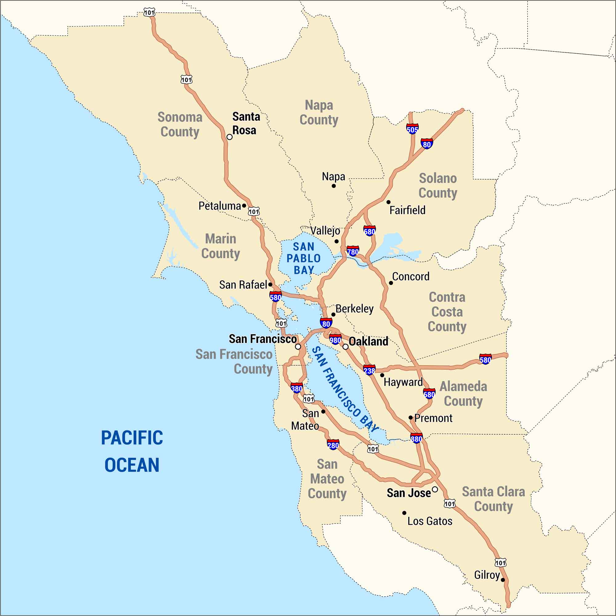
The Bay Area wraps around the water, from San Francisco down to San Jose and across to Oakland. Our map shows the cities, bridges, and highways that tie it all together.
Map Information
On the Map
Cities/Towns: Berkeley, Concord, Fairfield, Gilroy, Hayward, Los Gatos, Napa, Oakland, Petaluma, Premont, San Francisco, San Jose, San Mateo, San Rafael, Santa Rosa, Vallejo Counties: Alameda County, Contra Costa County, Marin County, Napa County, San Francisco County, San Mateo County, Santa Clara County, Solano County, Sonoma County Water Bodies: Pacific Ocean, San Francisco Bay, San Pablo Bay Roadways: I-80, US Hwy 101, State Rte 238, I-280, I-380, I-505, I-580, I-680, I-780, I-880, I-980Metropolitan Regions
Developed areas, suburban zones, and metro regions.