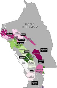
Sonoma Wine County Map
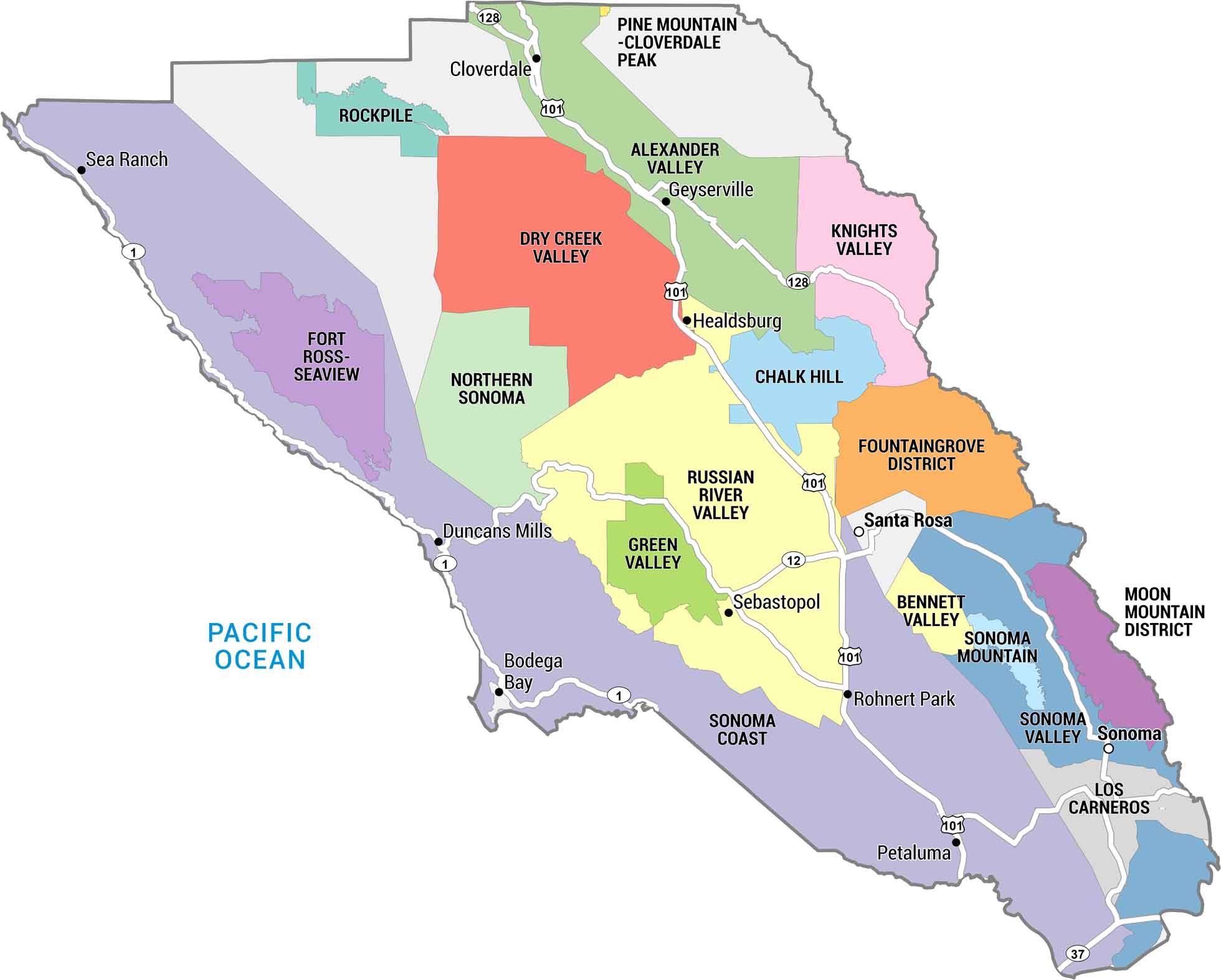
This map of Sonoma County highlights the region’s major cities, towns, and vineyard appellations. You can see how the valleys, hills, and coastlines shape one of the country’s top wine regions. Get a detailed look at where Sonoma’s grapes take root in California.
Map Information
On the Map
Wine Regions (AVAs): Alexander Valley, Bennett Valley, Chalk Hill, Dry Creek Valley, Fort Ross-Seaview, Fountaingrove District, Green Valley, Knights Valley, Los Carneros, Moon Mountain District, Northern Sonoma, Pine Mountain-Cloverdale Peak, Rockpile, Russian River Valley, Sonoma Coast, Sonoma Mountain, Sonoma Valley Cities/Towns: Bodega Bay, Cloverdale, Duncans Mills, Geyserville, Healdsburg, Petaluma, Rohnert Park, Santa Rosa, Sea Ranch, Sebastopol, Sonoma Highways: State Rte 1, State Rte 12, State Rte 37, US Hwy 101, State Rte 128 Water Bodies: Pacific OceanEconomic Region Maps
Regions defined by farming, industry, production, or economic identities.