West Michigan Map
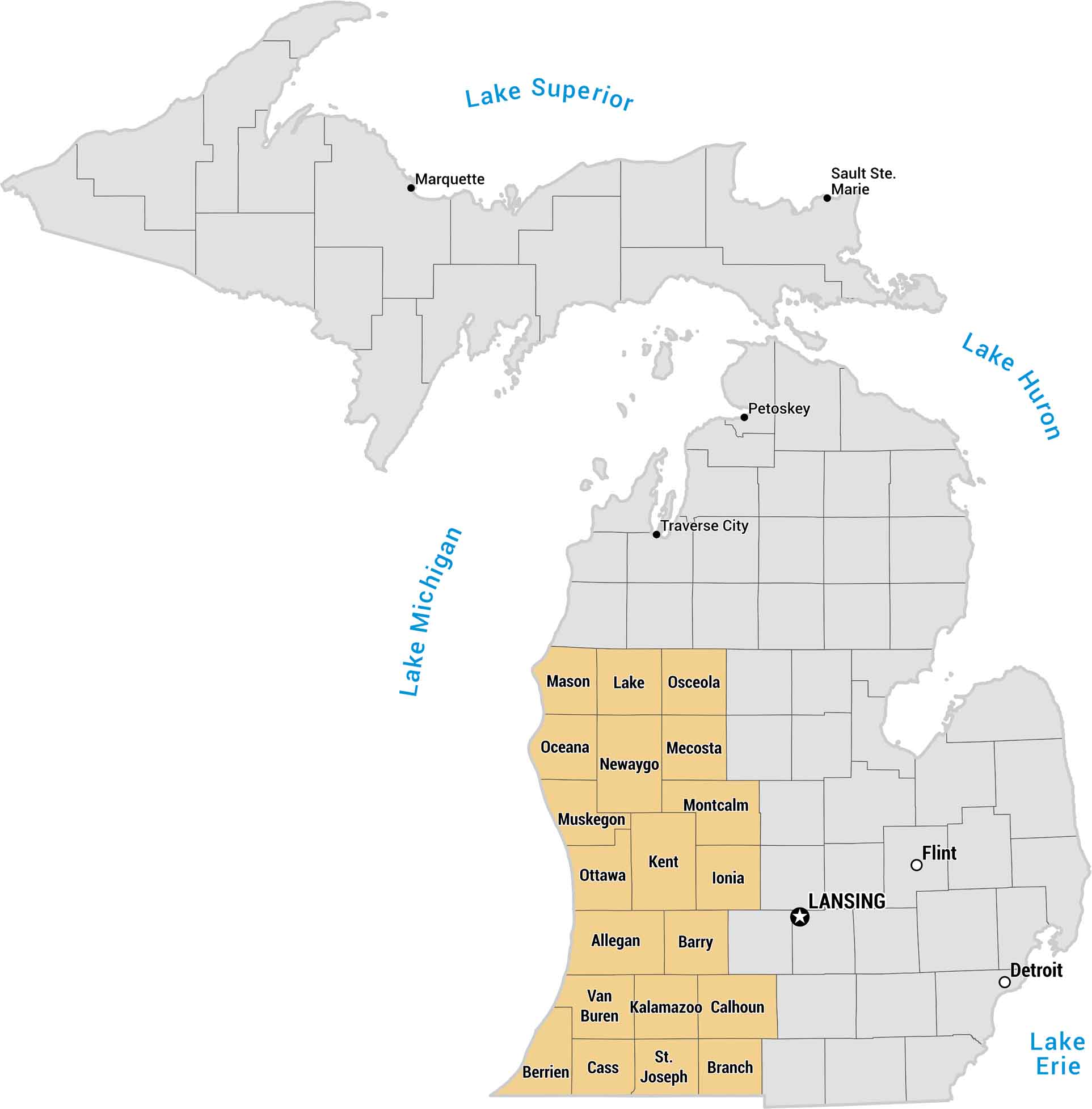
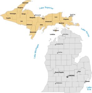
West Michigan is a region that stretch along Lake Michigan. Grand Rapids anchors the region, with Holland, Muskegon, and Saugatuck adding to the coast. Our West Michigan map shows counties, lakes and major cities.
Map Information
On the Map
West Michigan (Yellow Region)
These counties are part of the West Michigan Region.- Counties: Allegan, Barry, Berrien, Branch, Calhoun, Cass, Ionia, Kalamazoo, Kent, Lake, Mason, Mecosta, Montcalm, Muskegon, Newaygo, Oceana, Osceola, Ottawa, St. Joseph, Van Buren
Other Regions (Gray Region)
Here are major cities and bodies of water outside the highlighted West Michigan area.- Cities: Detroit, Flint, Lansing, Marquette, Petoskey, Sault Ste. Marie, Traverse City
- Bodies of Water: Lake Erie, Lake Huron, Lake Michigan, Lake Superior
Metropolitan Regions
Developed areas, suburban zones, and metro regions.