Map of Troy, New York
Troy is a Hudson River city with deep industrial history. Our map of Troy shows you around its historic downtown and its many parks.
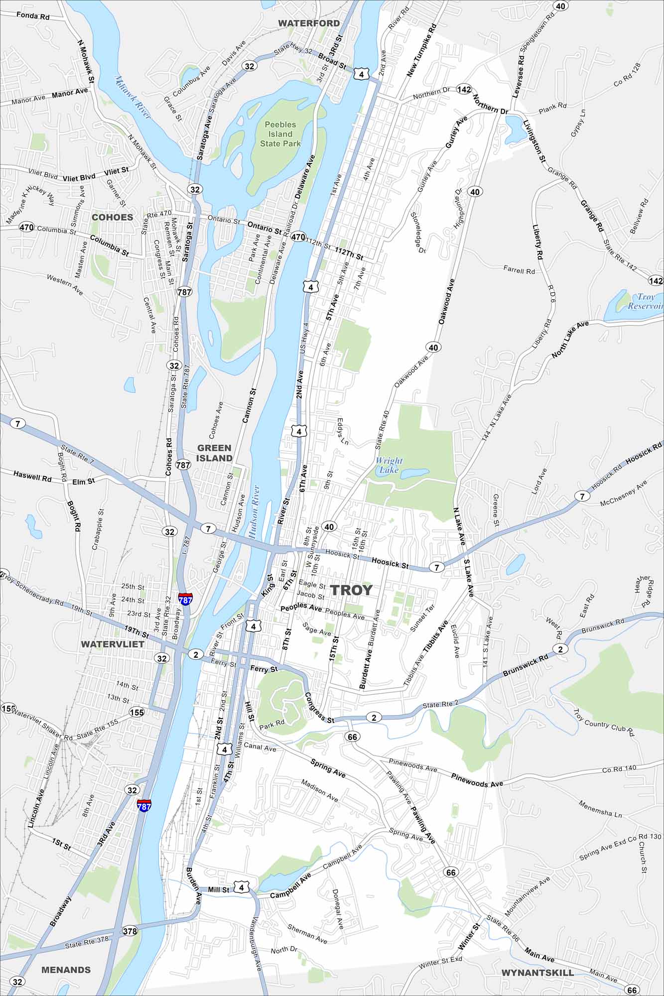
Map Information
On the Map
Interstates/Highways: I-787, US Hwy 4, State Rte 7, State Rte 2, State Rte 40, State Rte 32, State Rte 142, State Rte 66, State Rte 155, State Rte 378 Major Roads: Hoosick St, Congress St, Pawling Ave, Pinewoods Ave, Spring Ave, Campbell Ave, Burden Ave, River St, 2nd Ave, 112th St, Northern Blvd, Oakwood Ave, Lake Ave, Tibbits Ave, Burdett Ave, Sage Ave, Peoples Ave, Jacob St, Eagle St, King St Lakes and Reservoirs: Troy Reservoir, Wright Lake Major Rivers: Hudson River, Mohawk River Parks and Preserves: Peebles Island State Park Nearby Communities: Waterford, Cohoes, Green Island, Watervliet, Menands, WynantskillNew York State Maps
Find state maps of the Empire State.


City Maps of New York
Here are the city maps that define New York


