Downtown Indianapolis Map
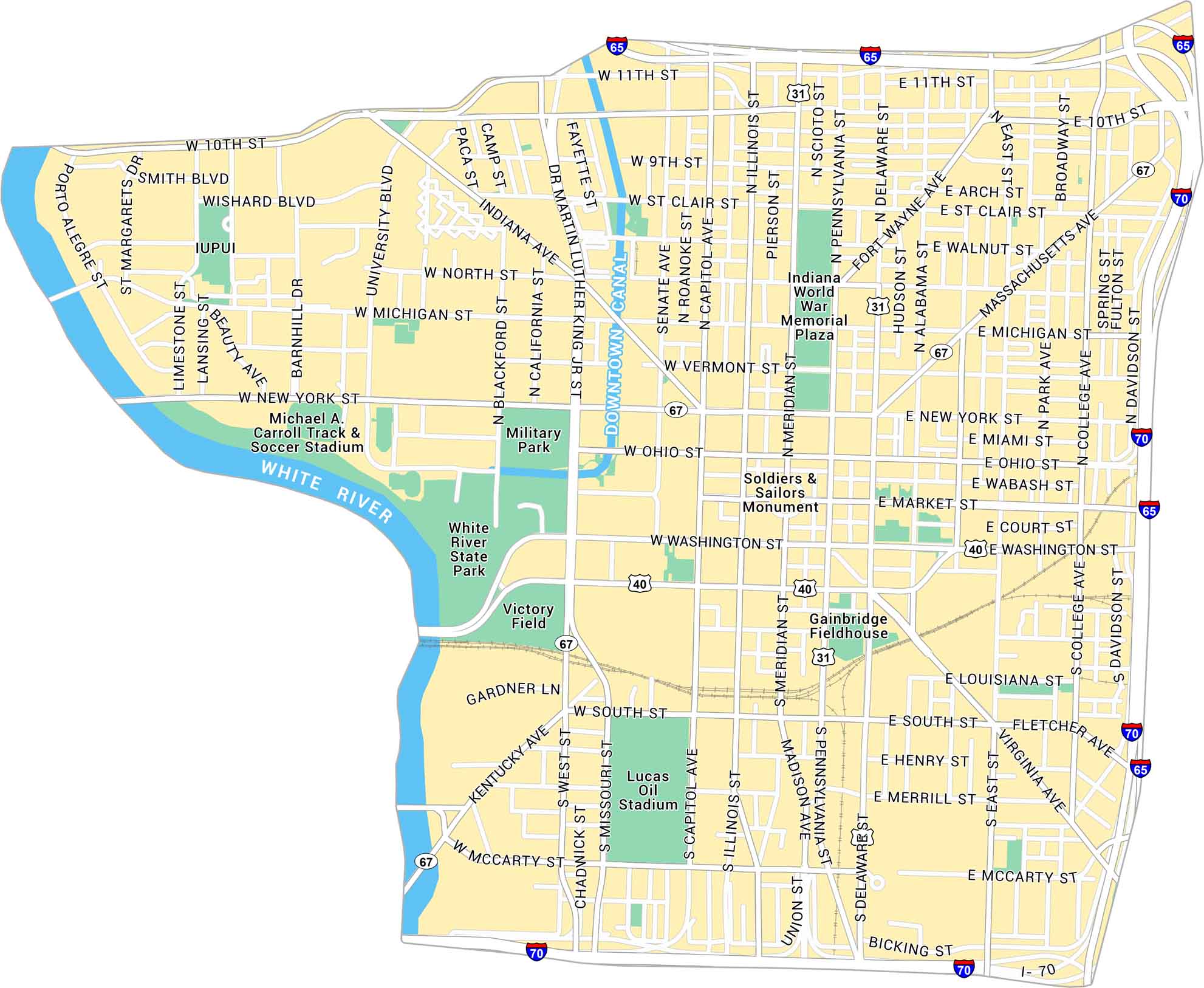
Our map of Downtown Indianapolis highlights the streets around Monument Circle and Lucas Oil Stadium. City streets, sporting venues and parks are all clear to see.
Map Information
On the Map
Interstates/Highways: I-65, I-70, US Hwy 40, US Hwy 31, State Rte 67 Major Roads: Meridian St, Washington St, Michigan St, New York St, Ohio St, Capitol Ave, Illinois St, Pennsylvania St, Delaware St, West St, South St, North St, Indiana Ave, Massachusetts Ave, Kentucky Ave, College Ave, Market St, Missouri St, Senate Ave, Dr Martin Luther King Jr St Major Rivers: White River, Downtown Canal Parks: White River State Park, Military Park, Indiana World War Memorial Plaza Landmarks: Lucas Oil Stadium, Gainbridge Fieldhouse, Victory Field, Michael A. Carroll Track & Soccer Stadium, Soldiers & Sailors Monument, IUPUIIndiana City Maps
Here are our maps of Indianapolis and Indiana cities


