Map of Utica, New York
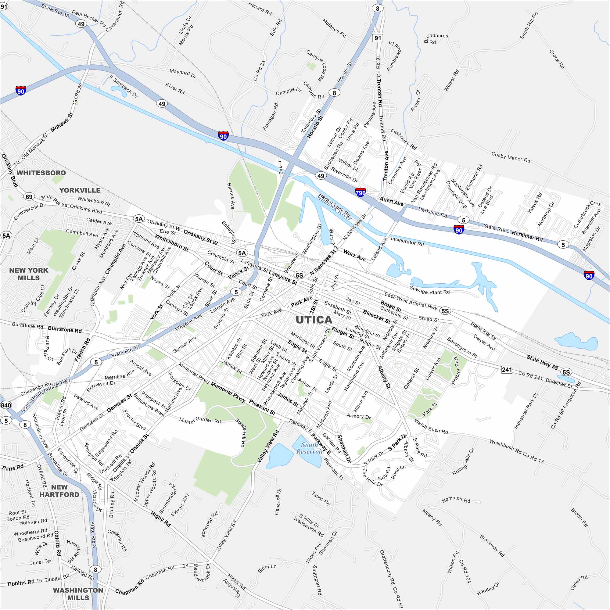
Utica is a Mohawk Valley city with rich immigrant history. Our map shows its highways, downtown streets, and of course, Mohawk River.
Map Information
On the Map
Interstates/Highways: I-90, I-790, State Rte 5, State Rte 8, State Rte 12, State Rte 49, State Rte 5S, State Rte 5A, State Rte 69, State Rte 840 Major Roads: Genesee St, Oriskany St, Memorial Pkwy, Burrstone Rd, Court St, York St, Whitesboro St, Broad St, Bleecker St, Culver Ave, Tilden Ave, Walker Rd, Higby Rd, French Rd, Champlain Ave, Bennett St, Sunset Ave, Herkimer Rd, Auert Ave, Trenton Rd Lakes and Reservoirs: South Reservoir Major Rivers: Mohawk River Nearby Communities: Whitesboro, Yorkville, New York Mills, New Hartford, Washington MillsNew York State Maps
Find state maps of the Empire State.


City Maps of New York
Here are the city maps that define New York


