Home » State Maps » Map of South Carolina

Map of South Carolina

South Carolina Map

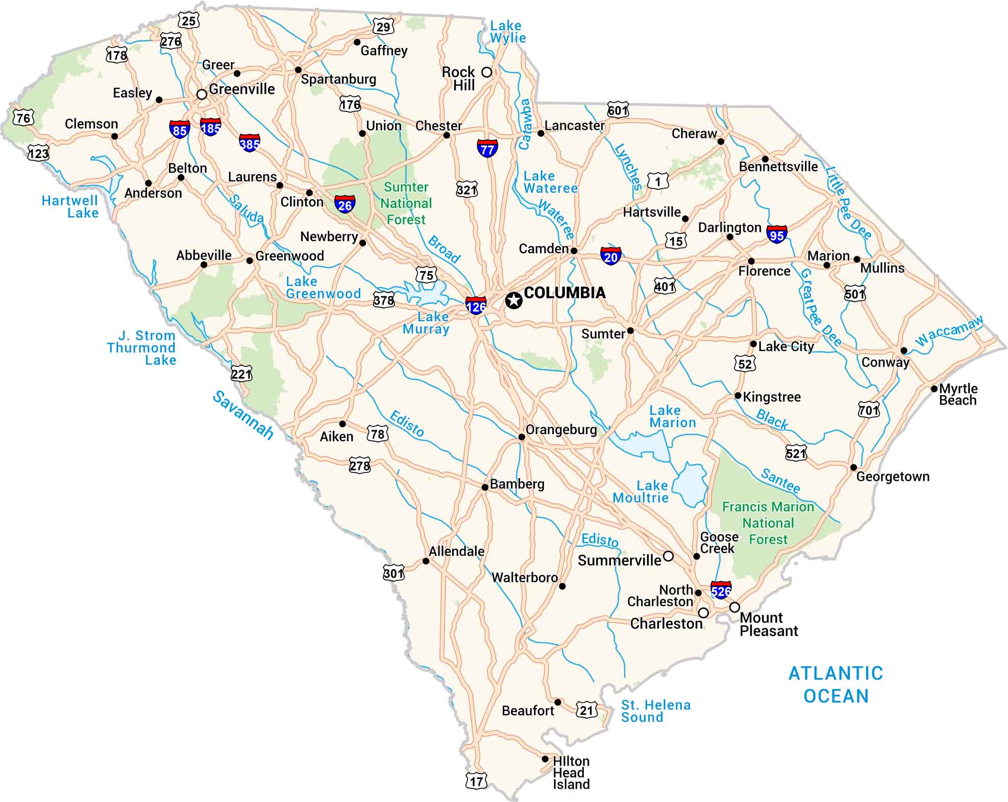
Our South Carolina map shows the highways that connect the Lowcountry to the upstate hills. You’ll spot rivers winding toward the Atlantic and lakes scattered through the center of the state. It’s warm, green, and full of southern charm.

Map Information

  • State of South Carolina
  • Road Map of South Carolina
  • Free for personal and commercial purpose. Attribution is required. How to attribute?

On the Map

South Carolina Location Map
State Capital: Columbia Major Cities: Charleston, Greenville, Mount Pleasant, Rock Hill, Summerville Cities and Towns: Abbeville, Aiken, Allendale, Anderson, Bamberg, Belton, Bennettsville, Camden, Chester, Clemson, Clinton, Conway, Darlington, Easley, Florence, Gaffney, Georgetown, Goose Creek, Greenwood, Greer, Hartsville, Hilton Head Island, Kingstree, Lake City, Lancaster, Laurens, Marion, Mullins, Myrtle Beach, Newberry, North Charleston, Orangeburg, Santee, Spartanburg, Sumter, Union, Walterboro Interstate Highways: I-20, I-26, I-77, I-85, I-95, I-126, I-185, I-385, I-526 US Routes: US-1, US-15, US-17, US-21, US-25, US-29, US-52, US-76, US-78, US-123, US-176, US-178, US-221, US-276, US-278, US-301, US-321, US-378, US-401, US-501, US-521, US-601, US-701 Lakes and Reservoirs: Hartwell Lake, J. Strom Thurmond Lake, Lake Greenwood, Lake Marion, Lake Moultrie, Lake Murray, Lake Wateree, Lake Wylie Rivers and Streams: Broad River, Catawba River, Edisto River, Great Pee Dee River, Little Pee Dee River, Lynches River, Saluda River, Santee River, Savannah River, Waccamaw River, Wateree River National Parks and Forests: Francis Marion National Forest, Sumter National Forest

City Maps of South Carolina

Find our maps of Charleston and South Carolina cities here

References

  1. Government Website of South Carolina
  2. South Carolina in Google Maps

Leave a Reply

Your email address will not be published. Required fields are marked *