Map of Yorkville, Illinois
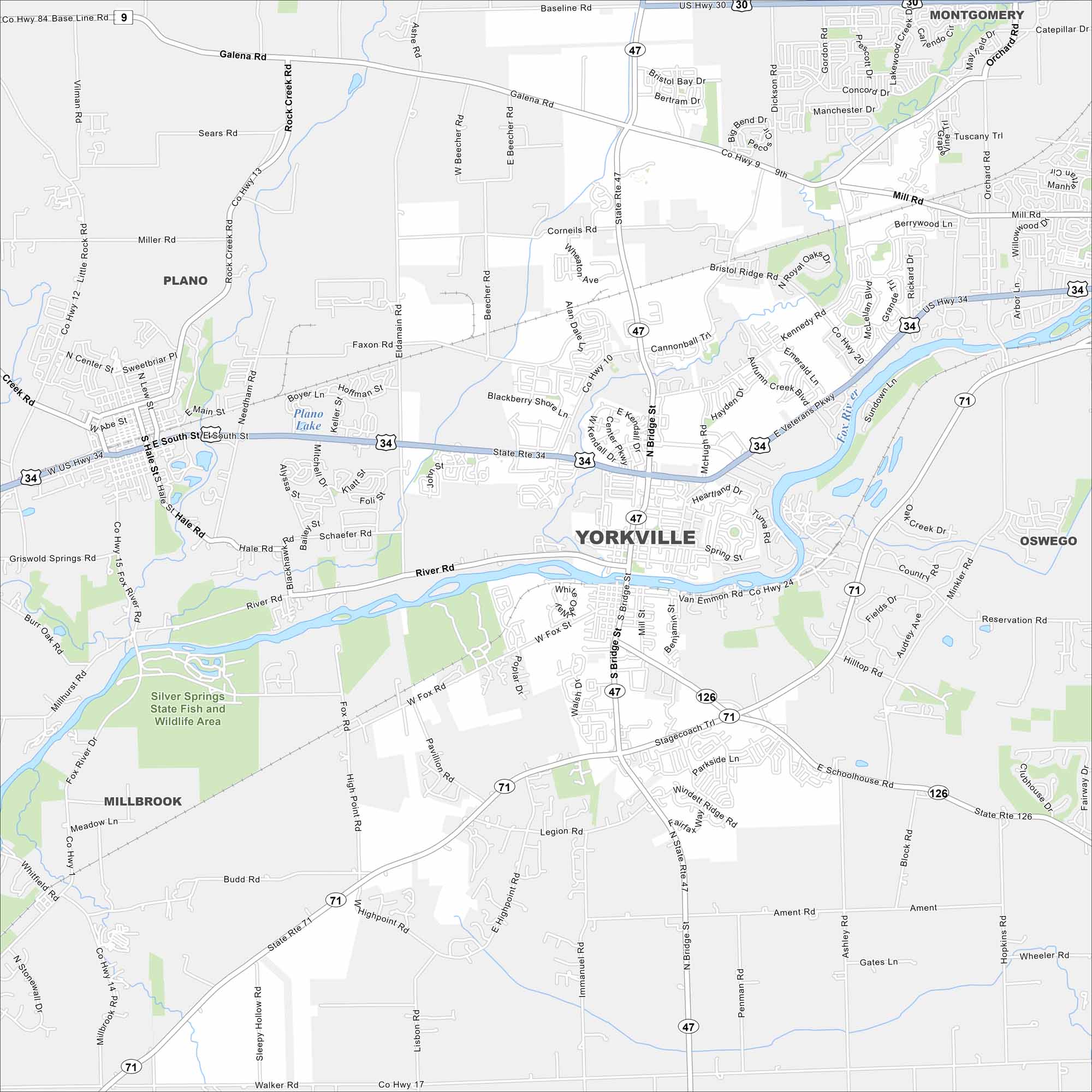
Looking for a map of Yorkville? You’ll find this city along the Fox River, which cuts through east to west. It also has a growing mix of suburban and small-town life.
Illinois State Maps
Get to know Illinois with our state maps


Map Information
On the Map
Interstates/Highways: US Hwy 34, US Hwy 30, State Rte 47, State Rte 71, State Rte 126 Major Roads: Bridge St, River Rd, Galena Rd, Baseline Rd, Cannonball Trl, Veterans Pkwy, Van Emmon Rd, Schoolhouse Rd, Budd Rd, Walker Rd, Fox River Dr, Game Farm Rd, Eldamain Rd, Beecher Rd, Mchugh Rd, Kennedy Rd Lakes and Reservoirs: Plano Lake Major Rivers: Fox River Parks and Preserves: Silver Springs State Fish and Wildlife Area Nearby Communities: Plano, Montgomery, Oswego, MillbrookIllinois City Maps
Explore Chicago and urban regions of Illinois


