Map of Wilmette, Illinois
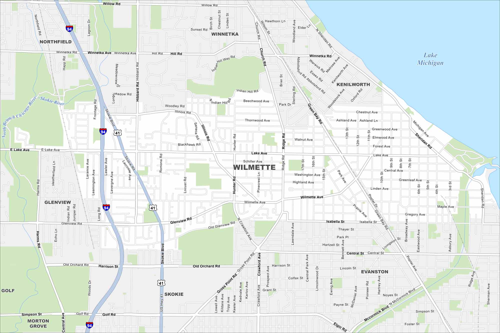
Here’s our map of Wilmette, a North Shore suburb of Chicago. Lake Michigan stands out in the northeast corner, as well as I-94 and US-41 to the west.
Illinois State Maps
Get to know Illinois with our state maps


Map Information
On the Map
Interstates/Highways: I-94, US Hwy 41 Major Roads: Lake Ave, Wilmette Ave, Green Bay Rd, Skokie Blvd, Ridge Rd, Hibbard Rd, Glenview Rd, Harrison St, Golf Rd, Old Orchard Rd, Winnetka Ave, Sheridan Rd, Central Ave, Illinois Rd, Hunter Rd, Frontage Rd, Illinois Rd, Locust Rd, Laramie Ave, Poplar Dr Lakes and Reservoirs: Lake Michigan Major Rivers: North Branch Chicago River Nearby Communities: Winnetka, Kenilworth, Northfield, Glenview, Evanston, Skokie, Morton Grove, GolfIllinois City Maps
Explore Chicago and urban regions of Illinois


