Map of West Jordan, Utah
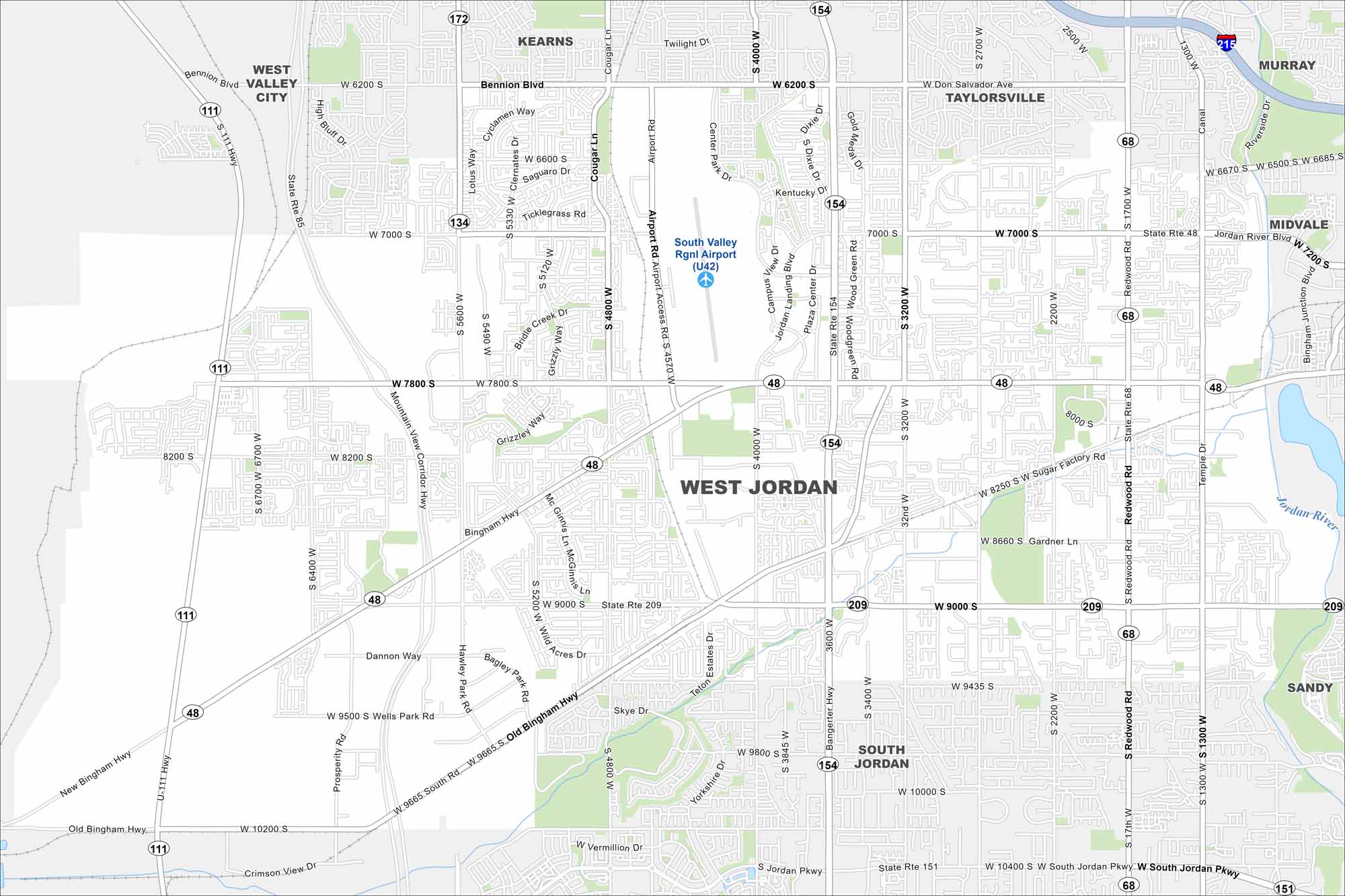
Our road map of West Jordan highlights the city’s neighborhoods near the Oquirrh Mountains. It’s a growing suburb with lots of parks and trails.
Map Information
On the Map
Interstates/Highways: I-215, State Rte 154, State Rte 48, State Rte 68, State Rte 209, State Rte 172, State Rte 111, State Rte 85, State Rte 151 Major Roads: Bangerter Hwy, Redwood Rd, Jordan Landing Blvd, Airport Rd, 7000 S, 7800 S, 9000 S, 2700 W, 3200 W, 4000 W, 4800 W, 5600 W, Bingham Hwy, Old Bingham Hwy, New Bingham Hwy, Wells Park Rd, South Jordan Pkwy, Sugar Factory Rd, Gardner Ln, Copper City Dr Airports: South Valley Rgnl Airport (U42) Major Rivers: Jordan River Nearby Communities: Kearns, Taylorsville, Murray, Midvale, Sandy, South Jordan, West Valley CityUtah State Maps
Look through maps of deserts, parks, and cities.


City Maps of Utah
Here is Salt Lake City and Utah’s urban regions.


