Map of Villa Park, Illinois
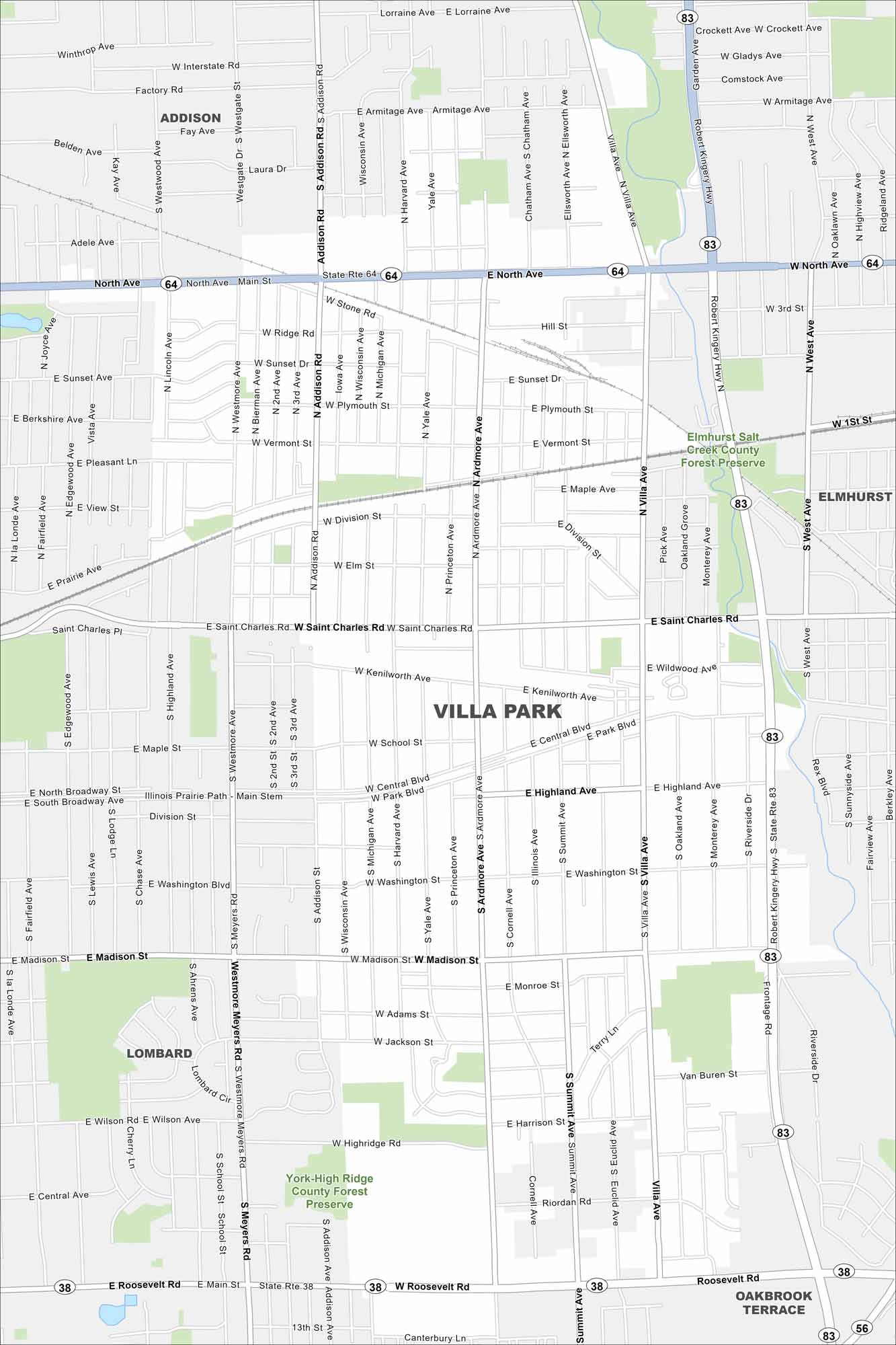
Familiarize yourself with Villa Park, a small DuPage County suburb. The map shows quiet neighborhoods, parks, and easy rail access.
Illinois State Maps
Get to know Illinois with our state maps


Map Information
On the Map
Interstates/Highways: I-83, State Rte 64, State Rte 38 Major Roads: North Ave, Roosevelt Rd, Addison Rd, Saint Charles Rd, Villa Ave, Madison St, Ardmore Ave, Summit Ave, Monterey Ave, Harvard Ave, Michigan Ave, Yale Ave, Princeton Ave, Cornell Ave, Illinois Ave, Westmore Meyers Rd, Central Blvd, Highland Ave, Park Blvd, Kenilworth Ave Parks and Preserves: Elmhurst Salt Creek County Forest Preserve, York-High Ridge County Forest Preserve Nearby Communities: Addison, Elmhurst, Oakbrook Terrace, LombardIllinois City Maps
Explore Chicago and urban regions of Illinois


