US Fault Lines Map
This US fault lines map plots major fracture zones. California’s San Andreas gets most of the spotlight. But it’s not just on the West Coast.
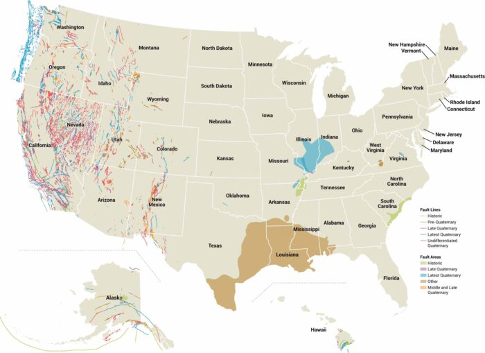
This US fault lines map plots major fracture zones. California’s San Andreas gets most of the spotlight. But it’s not just on the West Coast.
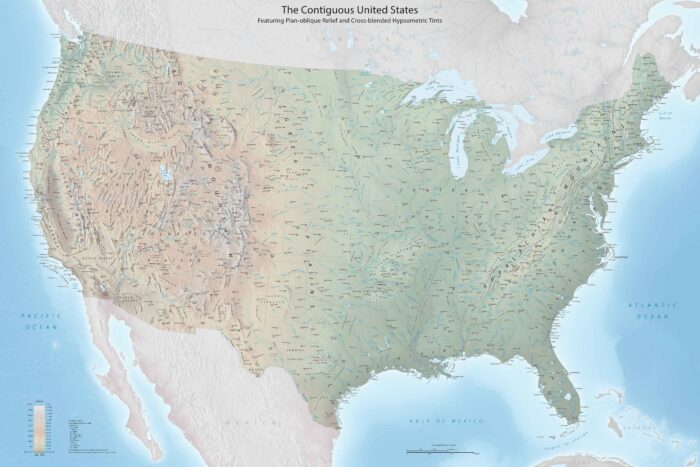
This US topographic map packs in terrain features, state outlines and interstates. Our map of US topography doesn’t hold back on detail.
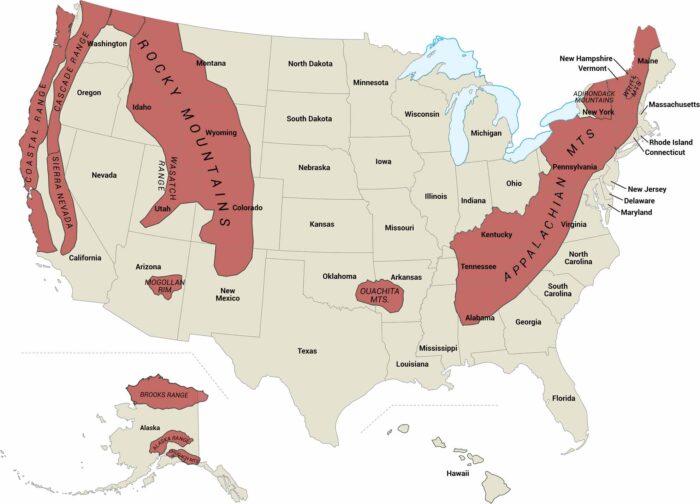
Mountains define half of America’s landscape. Our US mountains map shows where the Rockies, Appalachians, and other ranges overlap.
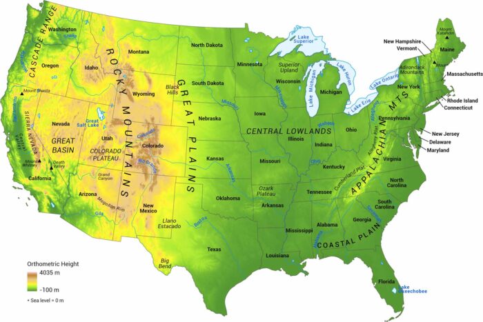
Elevation in the United States ranges from sea level to high mountain peaks. Our US elevation map shows terrain in the United States.
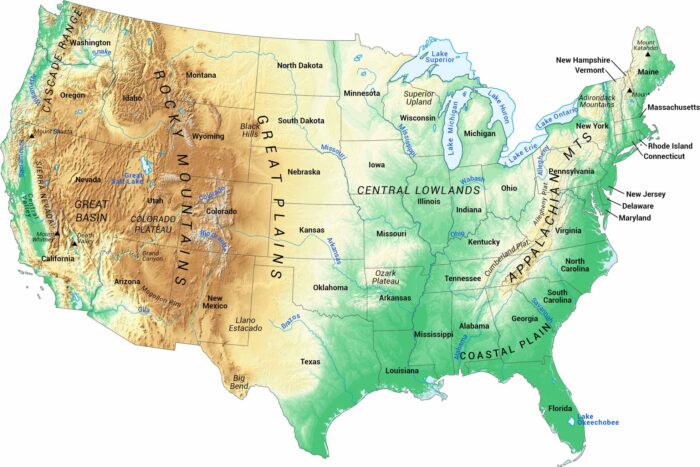
Our map of U.S. terrain covers all 48 contiguous states. It highlights major landforms, from mountain ranges to broad plains.
Our US hillshade map shows you exactly where the land rises and falls across the country. Mountain ranges, plateaus, and valleys stand out.

Our map of America’s lakes and rivers shows the major waterways and lakes that define the country’s landscape.
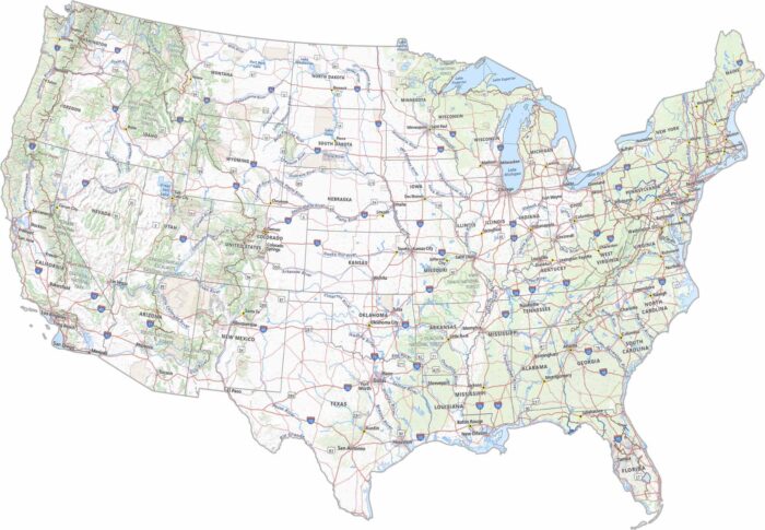
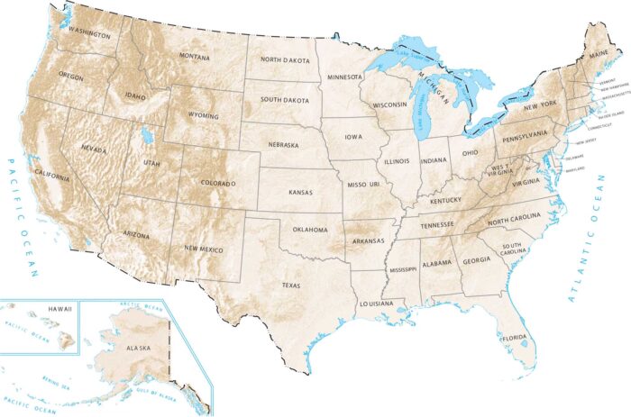
This is a high-resolution map with every detail you could need. Our USA detailed map has cities, physical features, state outlines, and more.
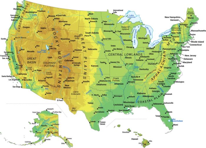
Our map shows the major physical features of the United States. We built this map to show you the geography that makes America what it is.
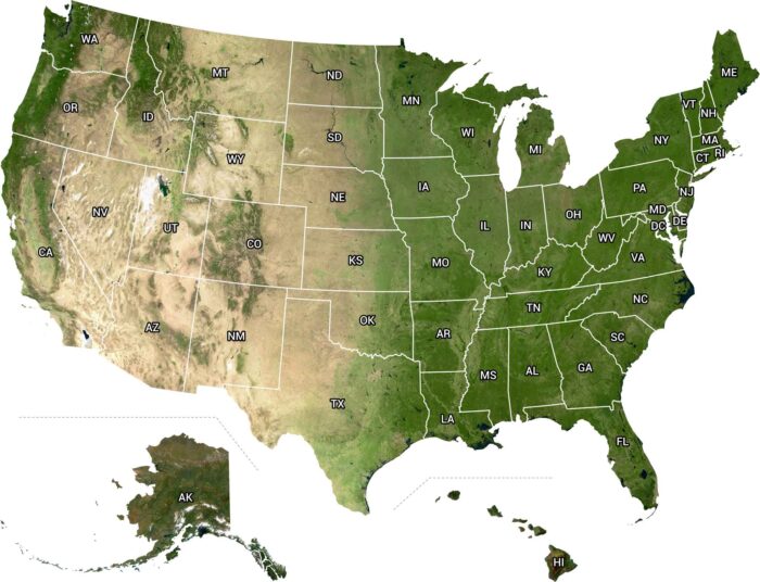
From above, the U.S. looks wild and alive. From the west to east coast, it’s a view that makes you realize how big this country really is.