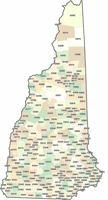
New Hampshire Zip Code Map
New Hampshire zip codes are compact and tightly arranged. Our map shows short distances between postal areas.
New Hampshire zip codes are compact and tightly arranged. Our map shows short distances between postal areas.
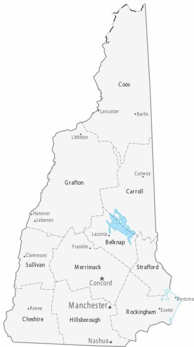
The 10 counties on our map of New Hampshire stretch from the small Atlantic coastline to the White Mountains.
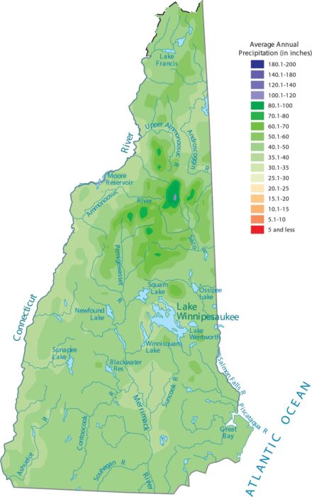
Our precipitation map of New Hampshire shows the White Mountains creating noticeably wetter conditions in the central part of the state.
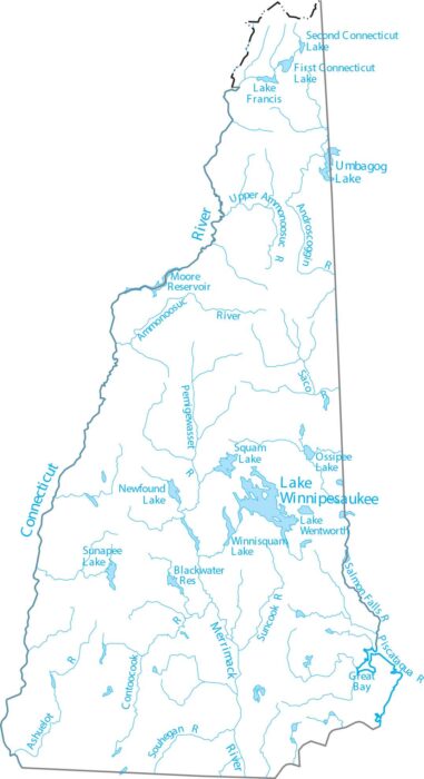
New Hampshire is in northern New England, with rivers flowing to the Atlantic. Our map highlights the Merrimack River, lakes and streams.
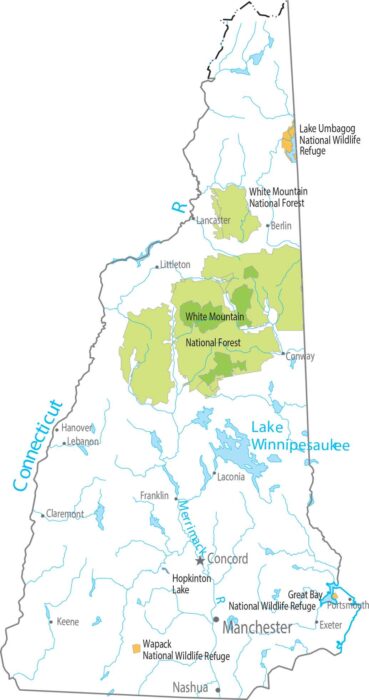
New Hampshire has no national parks. But it does have one of the most significant national forests – White Mountain National Forest.
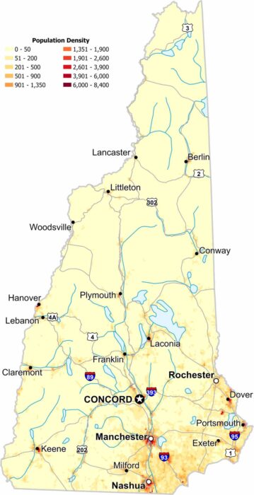
Check out our map to see population density in New Hampshire. While the southern region appears denser, forests remain dominant in the north.
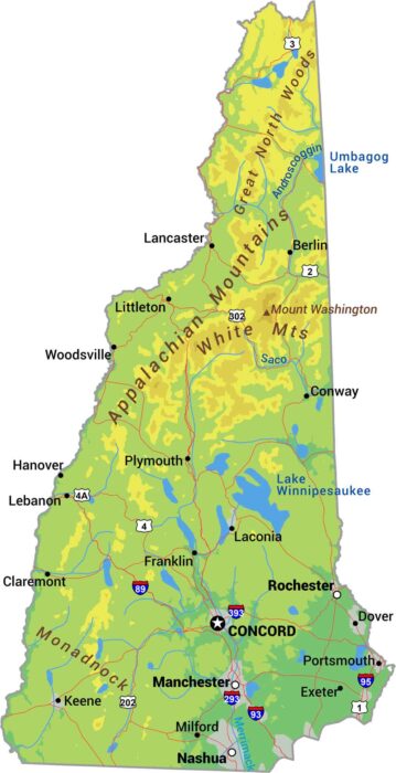
Our New Hampshire physical map shows its rugged terrain including the White Mountains and Mount Washington hitting 6,288 feet.
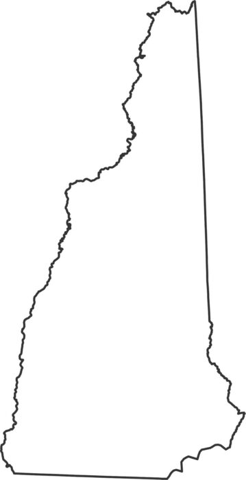
New Hampshire has a narrow shape with a small Atlantic coast. Our outline map highlights the Connecticut River along the western border.
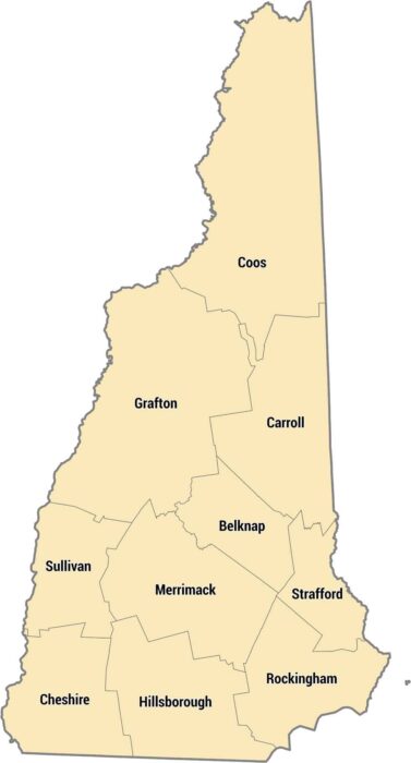
New Hampshire’s counties run from the Atlantic shoreline through forests and up into the White Mountains. This map shows its 10 counties.
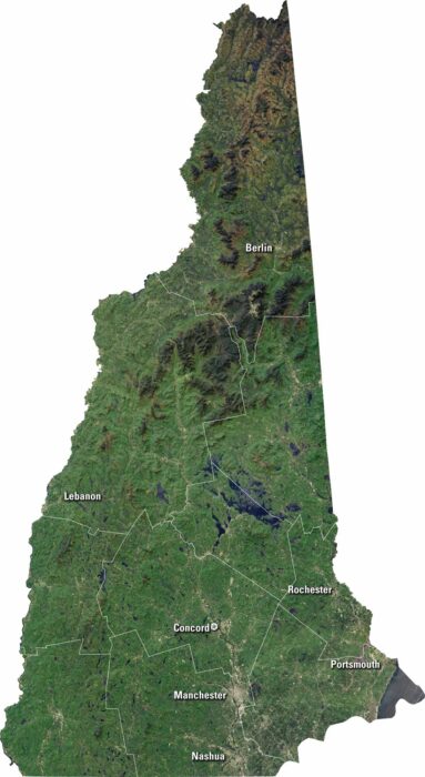
Get to know New Hampshire from above. Our satellite map shows its forests lakes and rivers. You’ll see Concord, Manchester, and Nashua.
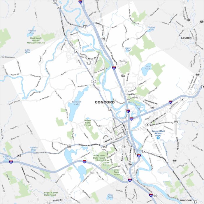
Concord is shown with Interstates 93 and 89 running through the city. As the state capital, it stands on the Merrimack River.
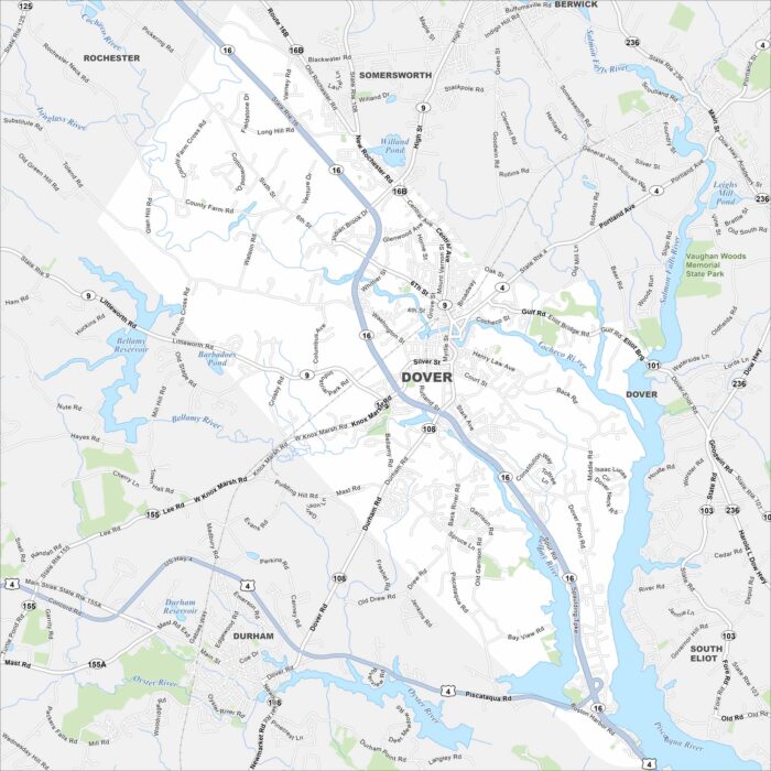
Dover is set in southeastern New Hampshire. It’s positioned between Piscataqua and Bellamy Rivers. This map shows its streets and waterways.
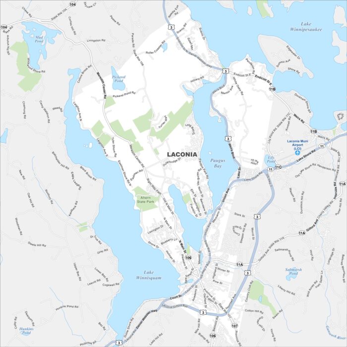
Laconia is located between Lake Winnipesaukee and Lake Winnisquam. Downtown streets cluster near the water.
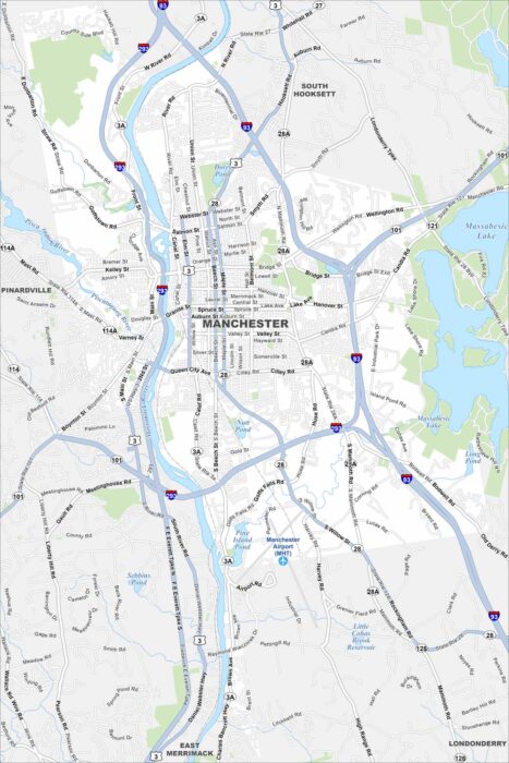
Manchester anchors southern New Hampshire. Our map displays the Merrimack River, which runs through its center.
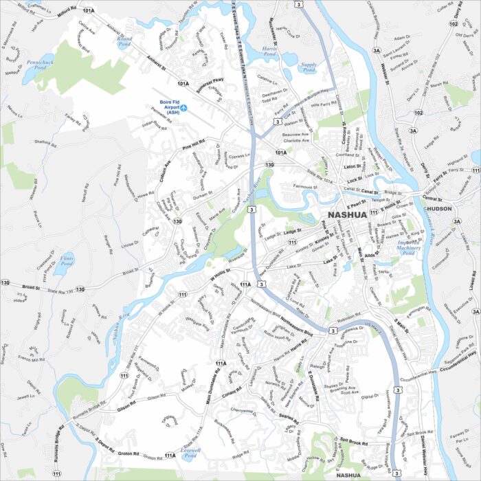
Our map of Nashua shows a city on the Merrimack and Nashua River. Neighborhoods fan out from a compact downtown