Map of Sumter, South Carolina
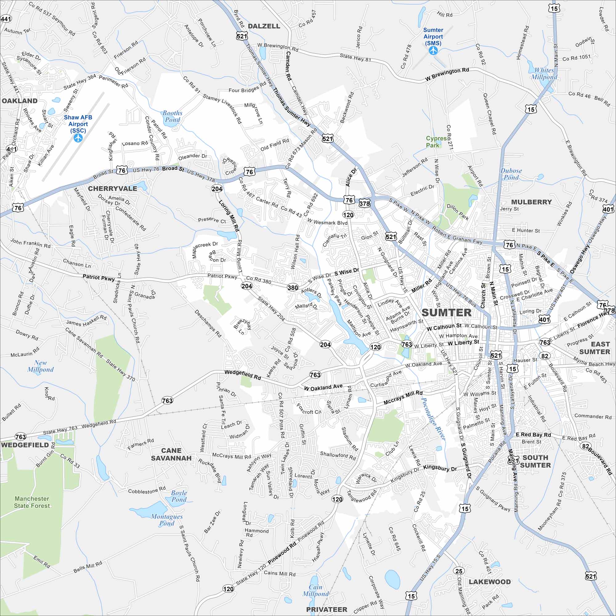
Here’s our map of Sumter, a city known for Swan Lake Iris Gardens. You’ll also find plenty of history tied to Shaw Air Force Base in the northwest.
Map Information
On the Map
Interstates/Highways: US Hwy 15, US Hwy 76, US Hwy 378, US Hwy 401, US Hwy 521, State Rte 120, State Rte 204, State Rte 380, State Rte 763 Major Roads: Broad St, Main St, Lafayette Dr, Guignard Dr, Liberty St, Calhoun St, Washington St, Hampton Ave, Oakland Ave, McCrays Mill Rd, Pinewood Rd, Patriot Pkwy, Loring Mill Rd, Alice Dr, Wesmark Blvd, Pike Blvd, Miller Rd, Bultman Dr, Wise Dr, Manning Ave Airports: Shaw AFB Airport (SSC), Sumter Airport (SMS) Lakes and Reservoirs: Booths Pond, Dubose Pond, Dillon Park Lake, Whites Millpond, Boyle Pond, Montagures Pond, Cain Millpond Major Rivers: Pocotaligo River Parks and Preserves: Manchester State Forest Nearby Communities: Dalzell, Oakland, Cherryvale, Mulberry, East Sumter, South Sumter, Lakewood, Privateer, Cane Savannah, WedgefieldSouth Carolina State Maps
Explore maps across the Palmetto State.


City Maps of South Carolina
Find our maps of Charleston and South Carolina cities here


