Map of St. Peters, Missouri
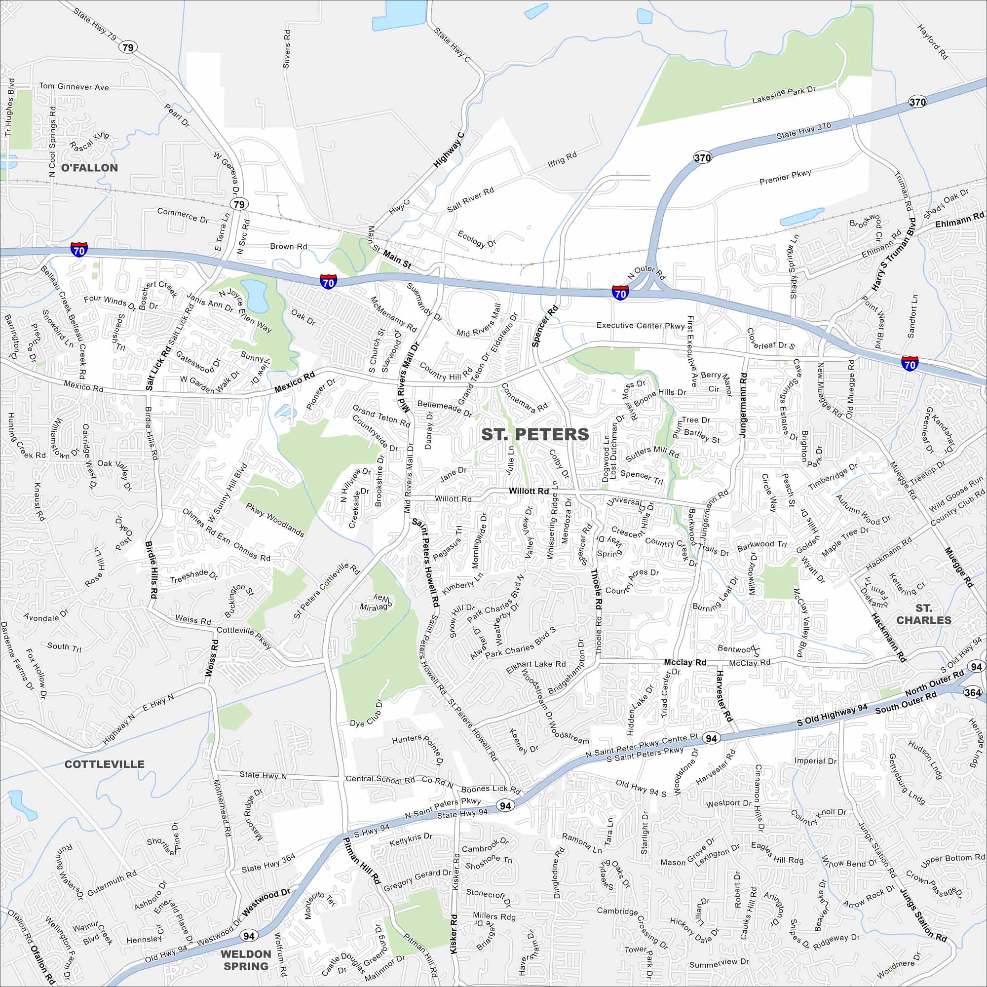
Here’s our map of St. Peters to help you get around this Missouri city. It’s known for family-friendly neighborhoods and its recreational activities.
Map Information
On the Map
Interstates/Highways: I-70, State Hwy 370, State Hwy 94, State Hwy 364, State Hwy 79 Major Roads: Mid Rivers Mall Dr, Mexico Rd, Willott Rd, Jungermann Rd, Harvester Rd, Suemandy Dr, Main St, Spencer Rd, Cave Springs Blvd, Truman Blvd, Premier Pkwy, Salt Lick Rd, Birdie Hills Rd, Ohmes Rd, Knaust Rd, McClay Rd, Westwood Dr, Pitman Hill Rd, Kisker Rd, Central School Rd Nearby Communities: O’Fallon, St. Charles, Cottleville, Weldon SpringMissouri State Maps
Check out state maps of the Show-Me State.


Missouri City Maps
Here are our city maps for Missouri


