Map of St. Joseph, Missouri
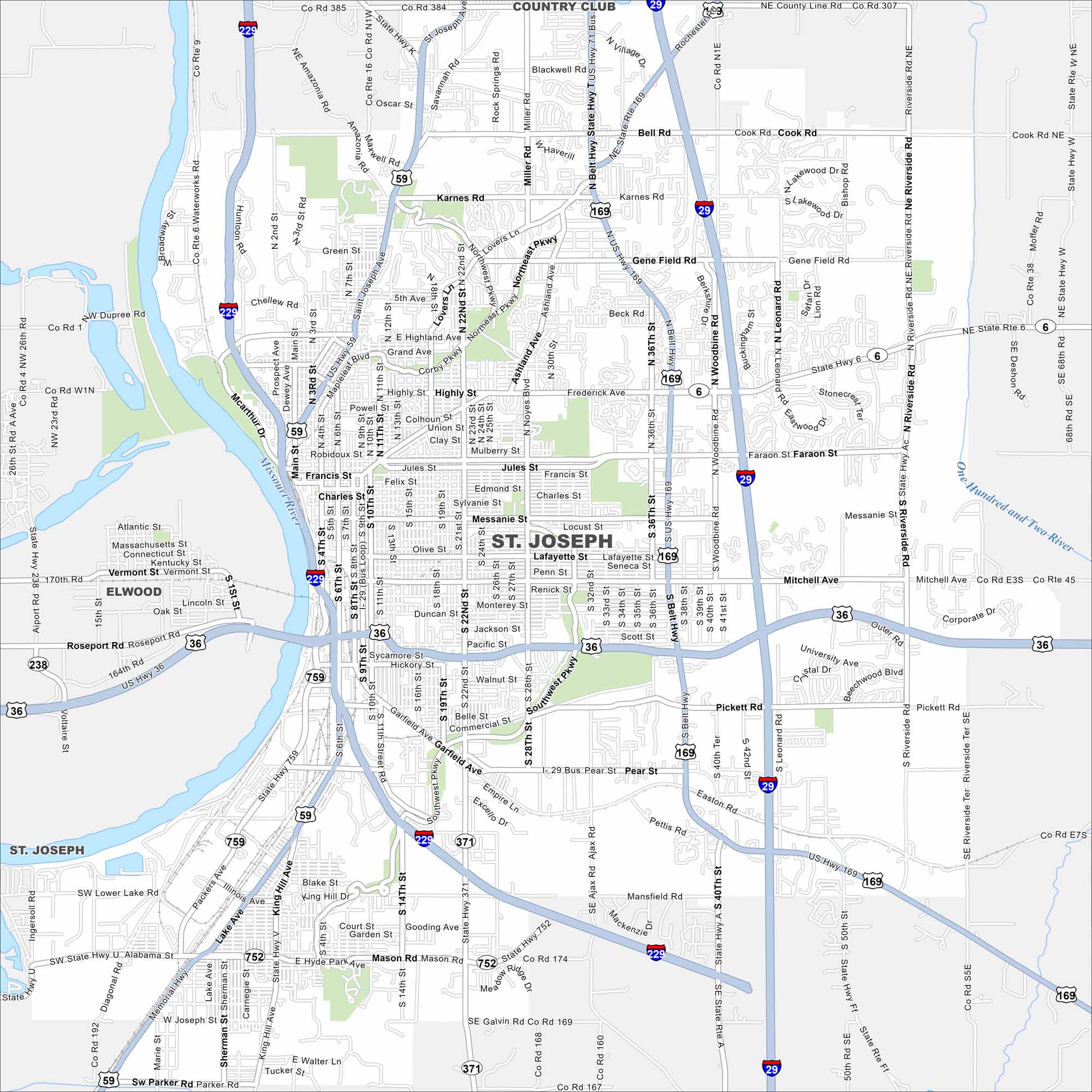
Familiarize yourself with St. Joseph using our map. The city is known for its Pony Express history, riverfront views, and historic architecture. The Missouri River forms its western border.
Map Information
On the Map
Interstates/Highways: I-229, I-29, US Hwy 36, US Hwy 59, US Hwy 71 Bus, US Hwy 169, State Hwy 6, State Hwy 752, State Hwy 759, Belt Hwy Major Roads: Frederick Ave, Riverside Rd, Gene Field Rd, Faraon St, Jules St, Francis St, Felix St, Edmond St, Charles St, Messanie St, Lafayette St, Mitchell Ave, Garfield Ave, Lake Ave, King Hill Ave, Mason Rd, Alabama St, Hyde Park Ave, 22nd St Major Rivers: Missouri River, One Hundred and Two River Nearby Communities: Country Club, ElwoodMissouri State Maps
Check out state maps of the Show-Me State.


Missouri City Maps
Here are our city maps for Missouri


