Map of Spartanburg, South Carolina
Our map of Spartanburg shows you around the hub of the Upstate. Colleges, history, and a growing downtown keep the city active.
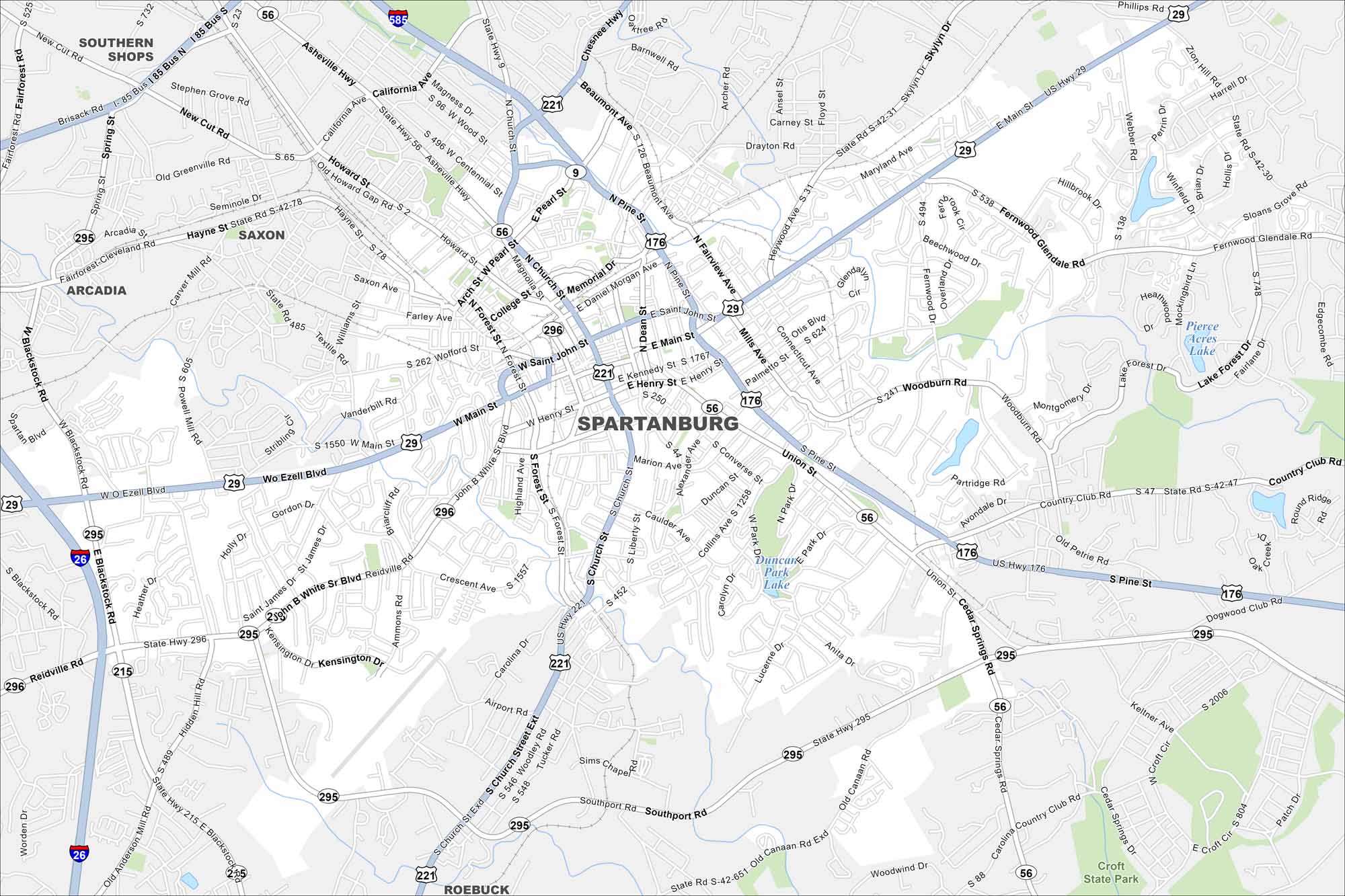
Map Information
On the Map
Interstates/Highways: I-26, I-85, I-585, US Hwy 29, US Hwy 176, US Hwy 221, State Rte 9, State Rte 56, State Rte 215, State Rte 295, State Rte 296 Major Roads: Main St, John B White Sr Blvd, Asheville Hwy, Pine St, Church St, Reidville Rd, Union St, Henry St, Wofford St, Blackstock Rd, Ezell Blvd, California Ave, Howard St, Pearl St, Daniel Morgan Ave, Saint John St, Kennedy St, Converse St, Alexander Ave, Southport Rd Lakes and Reservoirs: Duncan Park Lake, Pierce Acres Lake Nearby Communities: Southern Shops, Saxon, Arcadia, RoebuckSouth Carolina State Maps
Explore maps across the Palmetto State.


City Maps of South Carolina
Find our maps of Charleston and South Carolina cities here


