Map of Spanish Fork, Utah
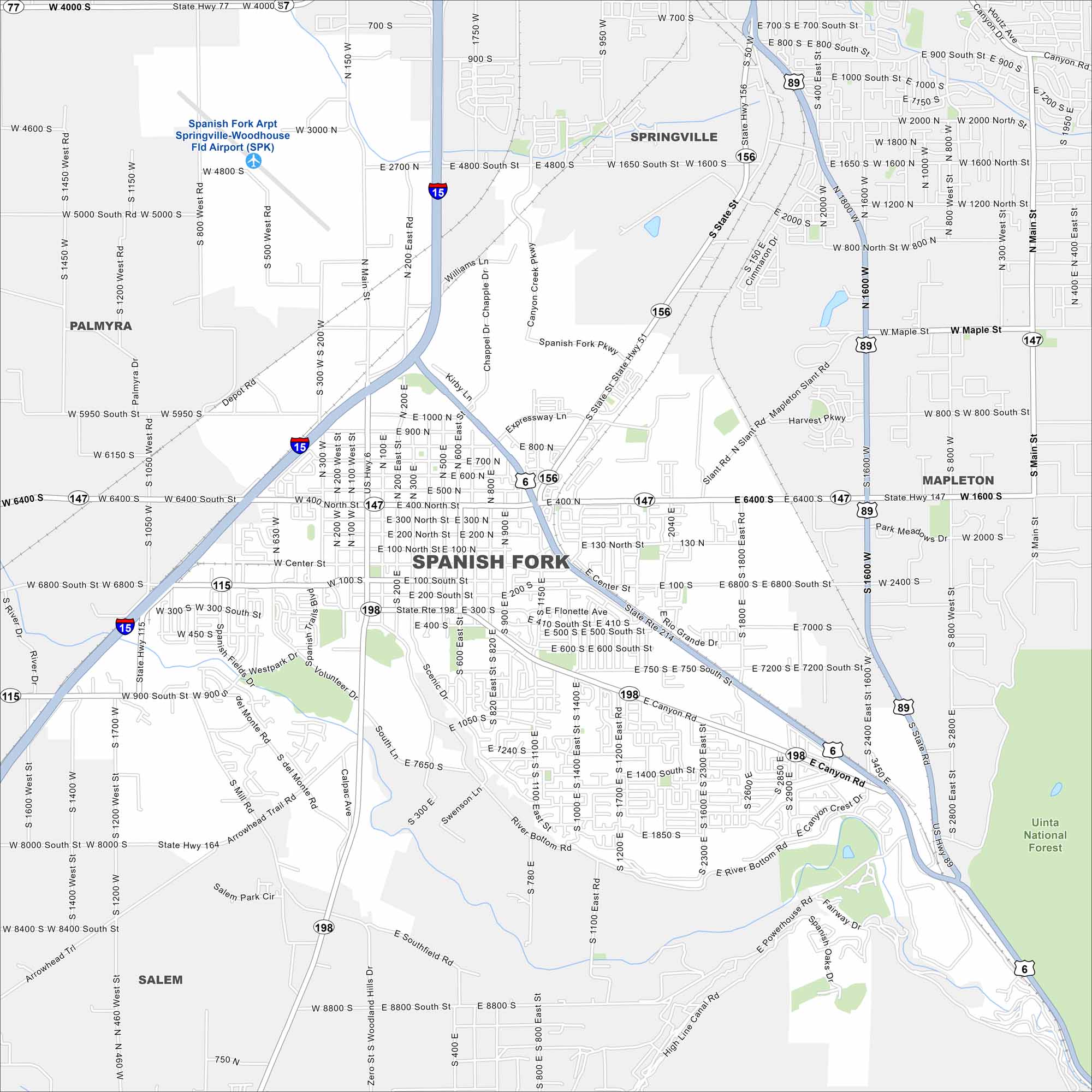
Our map of Spanish Fork helps you see the heart of Utah Valley. The city is known for its festivals, mountains, and family neighborhoods.
Map Information
On the Map
Interstates/Highways: I-15, US Hwy 6, US Hwy 89, State Rte 156, State Rte 198, State Rte 147, State Rte 115, State Rte 77, State Rte 164 Major Roads: Main St, Canyon Rd, Expressway Ln, Kirby Ln, 400 N, 800 N, 1000 N, 2700 N, 3000 N, Center St, 400 S, 800 S, 1000 S, 1400 S, 1600 S, 2000 S, 3200 S, Spanish Fork Pkwy, Volunteer Dr, Scenic Dr Airports: Spanish Fork Arpt Springville-Woodhouse Fld Airport (SPK) Nearby Communities: Springville, Mapleton, Salem, PalmyraUtah State Maps
Look through maps of deserts, parks, and cities.


City Maps of Utah
Here is Salt Lake City and Utah’s urban regions.


