Map of South Jordan, Utah
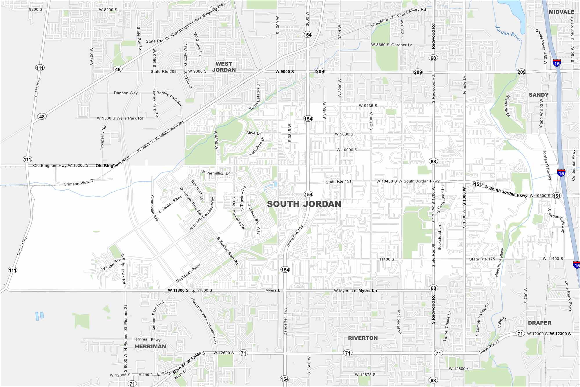
Our South Jordan map highlights a fast-growing suburb of Salt Lake City. It’s known for the Oquirrh Lake area and Jordan River, which cuts through.
Map Information
On the Map
Interstates/Highways: State Rte 154, State Rte 151, State Rte 68, State Rte 48, State Rte 209, State Rte 111, State Rte 71, State Rte 175, I-15 Major Roads: Bangerter Hwy, Redwood Rd, South Jordan Pkwy, 11400 S, 10600 S, 10400 S, 9000 S, 9800 S, 11800 S, 12600 S, 2700 W, 3200 W, 3600 W, 4000 W, 4800 W, 5600 W, Daybreak Pkwy, Riverfront Pkwy, Jordan Gateway, Centennial Pkwy Major Rivers: Jordan River Nearby Communities: South Jordan, West Jordan, Riverton, Herriman, Draper, Sandy, MidvaleUtah State Maps
Look through maps of deserts, parks, and cities.


City Maps of Utah
Here is Salt Lake City and Utah’s urban regions.


