Home » State Maps » Satellite Map of South Carolina

Satellite Map of South Carolina

South Carolina Satellite Map

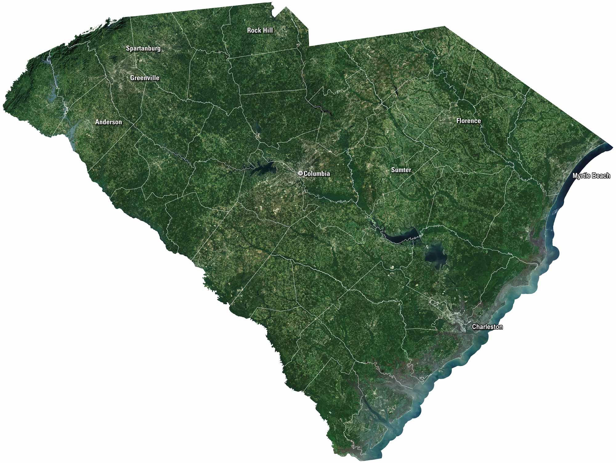
South Carolina blends coast, countryside, and history. See it on our satellite map, that includes Charleston and Columbia. The beaches at Myrtle Beach pull in crowds, but the Blue Ridge foothills give quiet escapes. Rivers flow through farmland, tying the lowcountry to the uplands.

Map Information

  • State of South Carolina
  • Satellite Map of South Carolina with Landsat-8 Imagery
  • Free for personal and commercial purpose. Attribution is required. How to attribute?

On the Map

South Carolina Location Map
Cities/Towns (Labels): Spartanburg, Greenville, Rock Hill, Anderson, Columbia, Sumter, Florence, Myrtle Beach, Charleston Lakes/Reservoirs: Lake Marion, Lake Moultrie, Lake Murray, Lake Jocassee Major Rivers: Santee River, Savannah River, Pee Dee River Landforms: Blue Ridge Mountains (top left corner), Atlantic Coastal Plain

References

  1. NASA Worldview Earthdata
  2. USGS State Mosaics

Leave a Reply

Your email address will not be published. Required fields are marked *