Map of Sandy, Utah
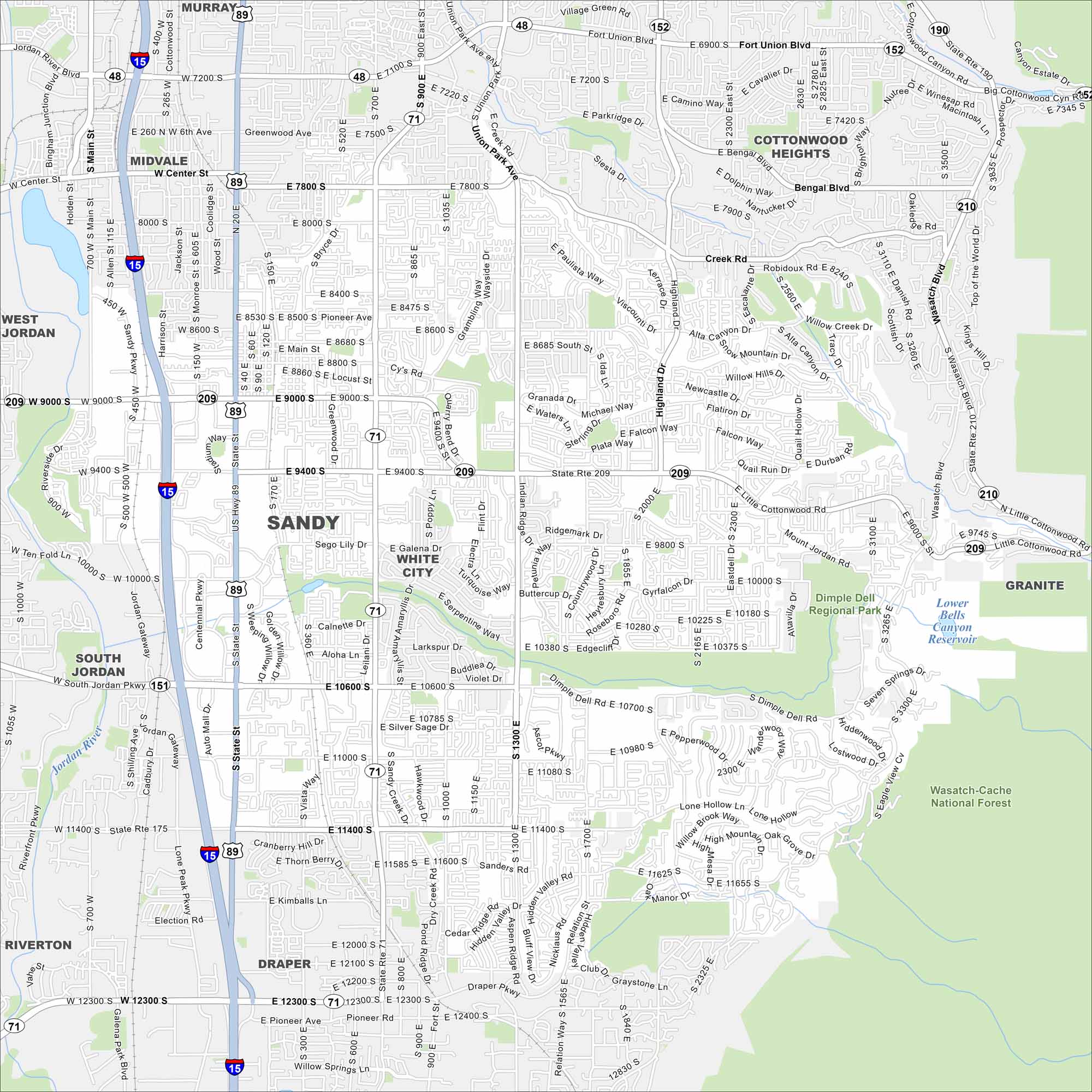
Our road map of Sandy, Utah makes it easy to reach shops, neighborhoods, and the Wasatch slopes. It’s a gateway to the mountains and wilderness.
Map Information
On the Map
Interstates/Highways: I-15, US Hwy 89, State Rte 209, State Rte 71, State Rte 151, State Rte 175, State Rte 48, State Rte 152, State Rte 190, State Rte 210 Major Roads: State St, 9000 S, 10600 S, 11400 S, 12300 S, 700 E, 1300 E, 2000 E, 2300 E, 7200 S, 7800 S, Fort Union Blvd, Wasatch Blvd, Union Park Ave, Highland Dr, Centennial Pkwy, Jordan Gateway, Lone Peak Pkwy, Riverfront Pkwy, Harrison St Lakes and Reservoirs: Lower Bells Canyon Reservoir Major Rivers: Jordan River Parks and Preserves: Wasatch-Cache National Forest, Dimple Dell Regional Park Nearby Communities: Midvale, White City, Cottonwood Heights, Granite, Draper, Riverton, South Jordan, West Jordan, MurrayUtah State Maps
Look through maps of deserts, parks, and cities.


City Maps of Utah
Here is Salt Lake City and Utah’s urban regions.


