Map of Sandpoint, Idaho
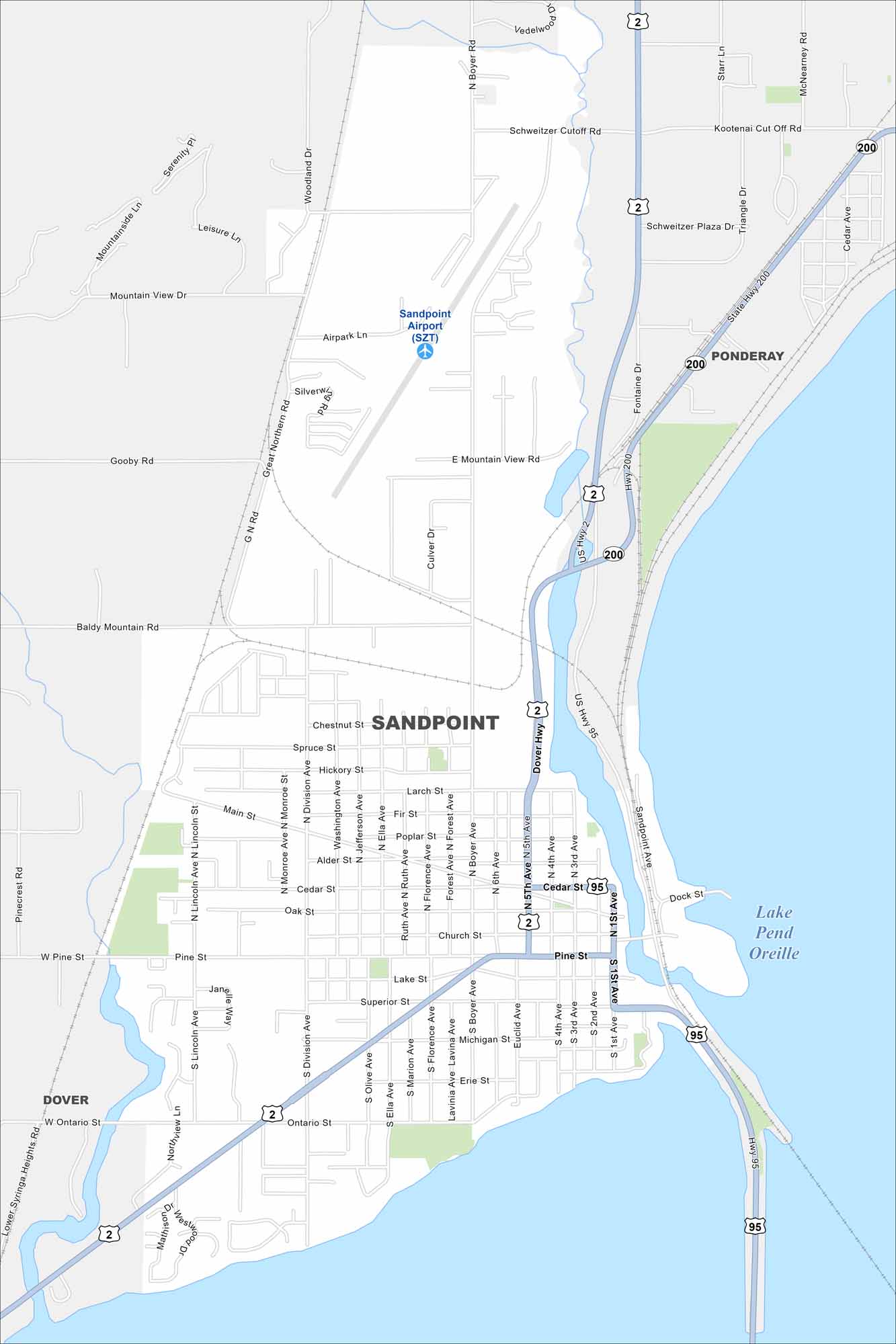
Here’s a simple map of Sandpoint, Idaho. Lake Pend Oreille and the nearby mountains make it one of Idaho’s most scenic spots.


Map Information
On the Map
Interstates/Highways: US Hwy 2, US Hwy 95, State Rte 200 Major Roads: Boyer Ave, Division Ave, Pine St, Cedar St, Superior St, Main St, Ontario St, Fifth Ave, First Ave, Larch St, Michigan St, Baldy Mountain Rd, Mountain View Rd, Schweitzer Cutoff Rd, Great Northern Rd, Woodland Dr, Northview Ln, Lincoln Ave, Monroe Ave, Washington Ave Airports: Sandpoint Airport (SZT) Lakes and Reservoirs: Lake Pend Oreille Nearby Communities: Ponderay, DoverIdaho City Maps
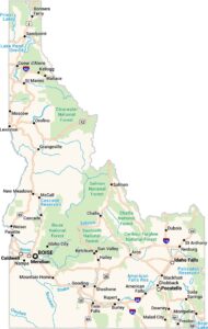
Boise and Idaho city maps right when you need them most