Map of Salt Lake City, Utah
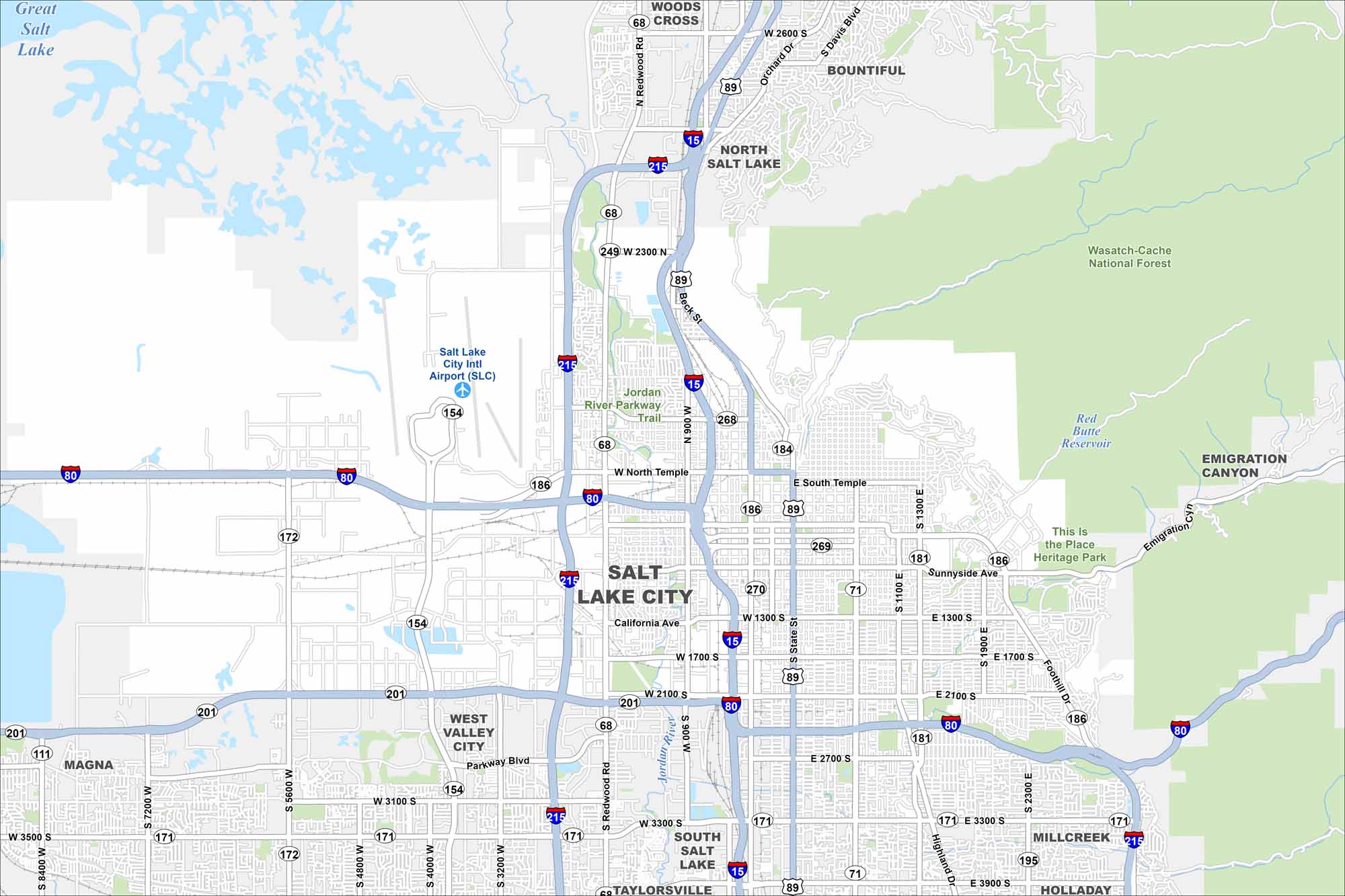
We’ve mapped out every major road in Salt Lake City. From the Great Salt Lake (top-left) to the foothills (top-right), our map helps you move through the capital.
Map Information
On the Map
Interstates/Highways: I-15, I-80, I-215, US Hwy 89, State Rte 201, State Rte 154, State Rte 171, State Rte 186, State Rte 181, State Rte 68, State Rte 268, State Rte 269, State Rte 270, State Rte 172, State Rte 111, State Rte 71 Major Roads: State St, North Temple, South Temple, Redwood Rd, 7200 W, 5600 W, 4800 W, 4000 W, 3200 W, 2100 S, 3300 S, 1300 S, 1700 S, 2700 S, 3900 S, Highland Dr, Foothill Dr, Sunnyside Ave, Parkway Blvd, Beck St Airports: Salt Lake City Intl Airport (SLC) Lakes and Reservoirs: Great Salt Lake, Red Butte Reservoir Major Rivers: Jordan River Parks and Preserves: Wasatch-Cache National Forest, Jordan River Parkway Trail, This Is The Place Heritage Park Nearby Communities: West Valley City, South Salt Lake, Millcreek, Holladay, Taylorsville, Magna, North Salt Lake, Bountiful, Woods Cross, Emigration Canyon Neighborhoods: Downtown Salt Lake CityUtah State Maps
Look through maps of deserts, parks, and cities.


City Maps of Utah
Here is Salt Lake City and Utah’s urban regions.


