Map of Rockford, Illinois
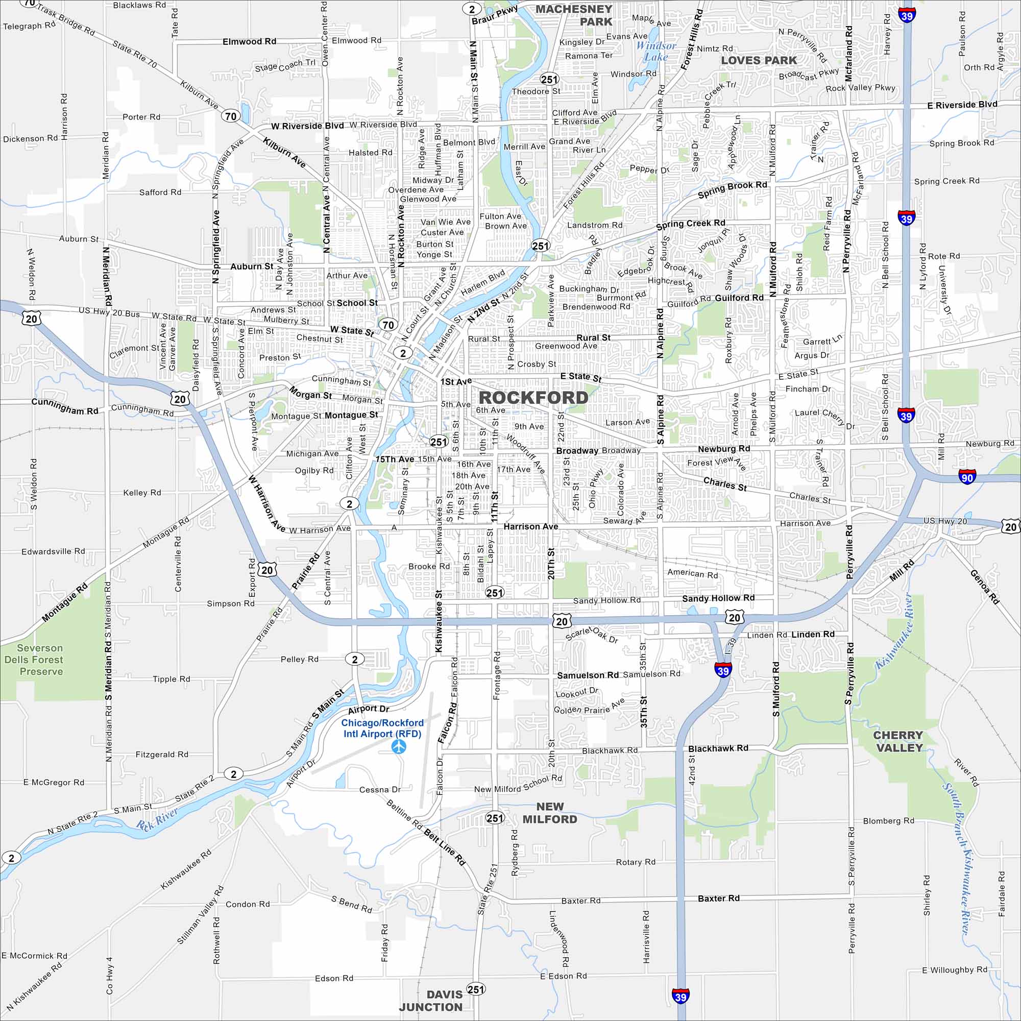
Get oriented with our Rockford, Illinois map. The streets and parks stand out. You’ll also notice the Rock River that cuts through the center of the city.
Illinois State Maps
Get to know Illinois with our state maps


Map Information
On the Map
Interstates/Highways: I-39, I-90, US Hwy 20, US Hwy 20 Bus, State Rte 70, State Rte 2, State Rte 251 Major Roads: State St, Riverside Blvd, Harrison Ave, Alpine Rd, 11th St, Kishwaukee St, Main St, Auburn St, Central Ave, Springfield Ave, Mulford Rd, Perryville Rd, Guilford Rd, Charles St, Broadway, Sandy Hollow Rd, Samuelson Rd, Blackhawk Rd, 20th St, Rockton Ave Airports: Chicago/Rockford Intl Airport (RFD) Major Rivers: Rock River, Kishwaukee River, South Branch Kishwaukee River Nearby Communities: Machesney Park, Loves Park, Cherry Valley, New Milford, Davis JunctionIllinois City Maps
Explore Chicago and urban regions of Illinois


