Map of Rock Island, Illinois
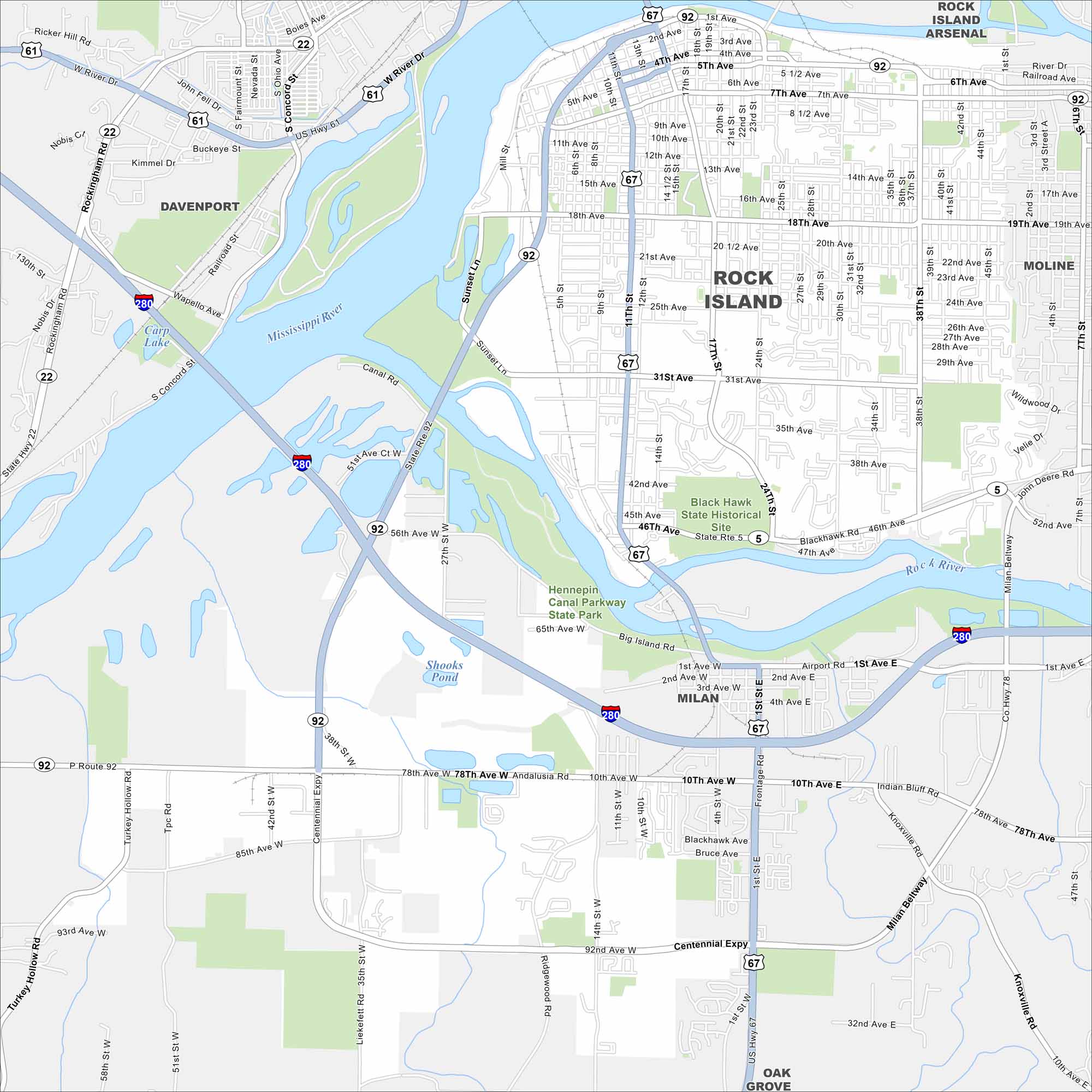
Our map of Rock Island displays the bridges, the riverfront, and the grid of city streets. You’ll know how it links across the Mississippi River in the west.
Illinois State Maps
Get to know Illinois with our state maps


Map Information
On the Map
Interstates/Highways: I-280, US Hwy 67, US Hwy 61, US Hwy 6, State Rte 92, State Rte 5, Centennial Expy Major Roads: 11th St, 24th St, 31st Ave, 18th Ave, 17th St, 4th Ave, Blackhawk Rd, Milan Beltway, Airport Rd, 78th Ave W, 92nd Ave, Andalusia Rd, Rockingham Rd, 12th St, 38th St, 41st St, 1st St, Indian Bluff Rd, Knoxville Rd Lakes and Reservoirs: Carp Lake, Shooks Pond Major Rivers: Mississippi River, Rock River Parks and Preserves: Black Hawk State Historical Site, Hennepin Canal Parkway State Park Nearby Communities: Davenport, Rock Island Arsenal, Moline, Milan, Oak GroveIllinois City Maps
Explore Chicago and urban regions of Illinois


