Map of Roanoke, Virginia
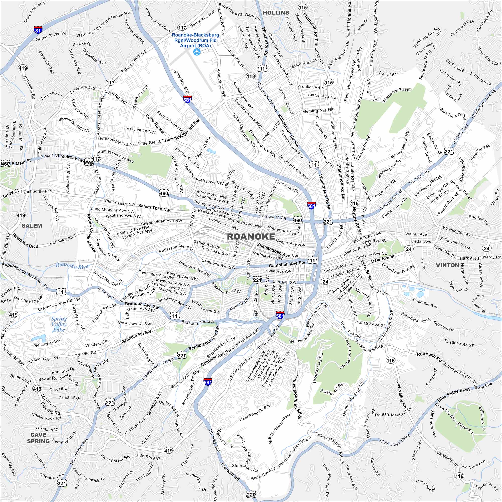
Our map of Roanoke shows the city center drawn out clearly. You can trace the roads toward the Blue Ridge Mountains and see I-581 connect to the city.
Map Information
On the Map
Interstates/Highways: I-81, I-581, US Hwy 11, US Hwy 220, US Hwy 460, State Rte 24, State Rte 101, State Rte 115, State Rte 116, State Rte 117, State Rte 118 Major Roads: Williamson Rd, Hershberger Rd, Melrose Ave, Orange Ave, Shenandoah Ave, Brandon Ave, Franklin Rd, Colonial Ave, Brambleton Ave, Electric Rd, Peter Creek Rd, Cove Rd, Airport Rd, Plantation Rd, Blue Ridge Pkwy, Main St, Apperson Dr, Challenger Ave, Hardy Rd, Welcome Valley Rd Airports: Roanoke-Blacksburg Rgnl/Woodrum Fld Airport (ROA) Lakes and Reservoirs: Spring Valley Lake Major Rivers: Roanoke River Nearby Communities: Hollins, Vinton, Cave Spring, SalemVirginia State Maps
Spanning coasts and mountains, here are our maps of Virginia.


City Maps of Virginia
Traverse Virginia using our city maps


