Map of Richmond, Virginia
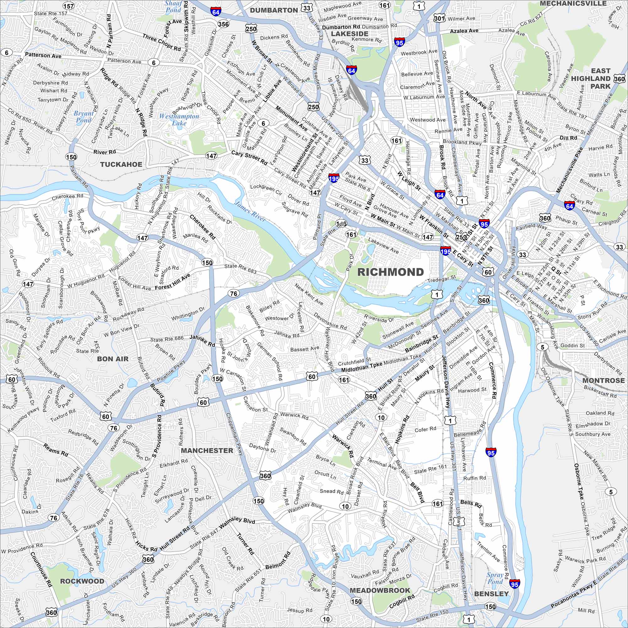
Richmond is Virginia’s capital and one of the nation’s most historic cities. The James River winds right through town, shaping its roads and neighborhoods. Patrick Henry’s famous “Give me liberty” speech was delivered here.
Map Information
On the Map
Interstates/Highways: I-64, I-95, I-195, US Hwy 1, US Hwy 33, US Hwy 60, US Hwy 250, US Hwy 301, US Hwy 360, State Rte 5, State Rte 6, State Rte 10, State Rte 76, State Rte 147, State Rte 150, State Rte 161 Major Roads: Broad St, Main St, Monument Ave, Cary St, Hull St, Midlothian Tpke, Belt Blvd, Parham Rd, Three Chopt Rd, Patterson Ave, River Rd, Forest Hill Ave, Jahnke Rd, Chippenham Pkwy, Huguenot Rd, Brook Rd, Chamberlayne Ave, Laburnum Ave, Commerce Rd, Jefferson Davis Hwy Lakes and Reservoirs: Westhampton Lake, Bryant Pond, Swan Lake, Shields Lake, Spray Pond Major Rivers: James River Nearby Communities: Dumbarton, Lakeside, Mechanicsville, East Highland Park, Montrose, Bensley, Meadowbrook, Rockwood, Manchester, Bon Air, TuckahoeVirginia State Maps
Spanning coasts and mountains, here are our maps of Virginia.


City Maps of Virginia
Traverse Virginia using our city maps


