Map of Provo, Utah
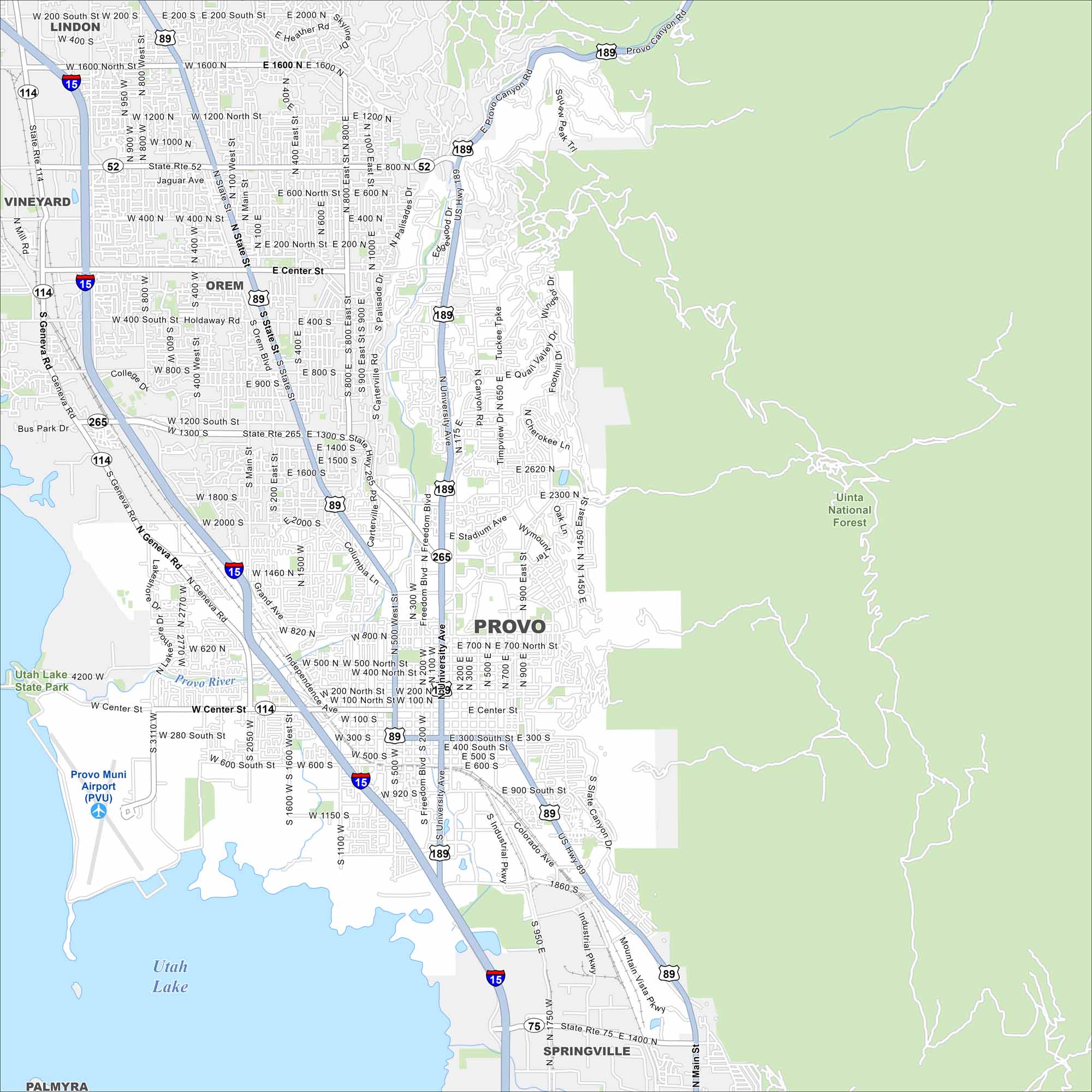
Located between Utah Lake and the Wasatch Mountains, Provo is full of scenic views. Our map highlights downtown and connecting roads. Uinta National Forest occupies the east of Provo, great for camping and hiking.
Map Information
On the Map
Interstates/Highways: I-15, US Hwy 189, US Hwy 89, State Rte 52, State Rte 114, State Rte 265, State Rte 115, State Rte 75 Major Roads: University Ave, State St, Center St, Geneva Rd, Columbia Ln, Freedom Blvd, Industrial Pkwy, Canyon Rd, University Pkwy, Main St, Orem Blvd, Sandhill Rd, Mountain Vista Pkwy, Lakeview Pkwy, Independence Ave, Foothill Dr, Grand Ave, Bulldog Blvd, Timpview Dr, Slate Canyon Dr Airports: Provo Muni Airport (PVU) Lakes and Reservoirs: Utah Lake Major Rivers: Provo River Parks and Preserves: Uinta National Forest Nearby Communities: Provo, Orem, Lindon, Vineyard, Springville, PalmyraUtah State Maps
Look through maps of deserts, parks, and cities.


City Maps of Utah
Here is Salt Lake City and Utah’s urban regions.


