Map of Portsmouth, Virginia
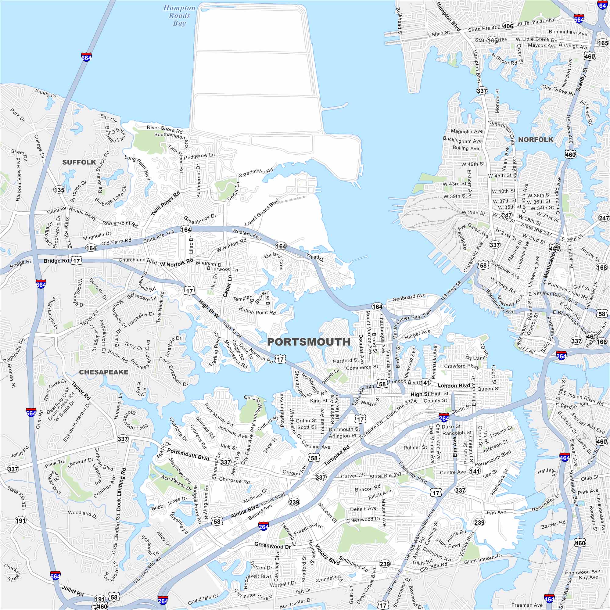
Portsmouth sits on the Elizabeth River across from Norfolk. Shipping channels and docks line the waterfront. You’ll also notice historic neighborhoods and military facilities nearby.
Map Information
On the Map
Interstates/Highways: I-664, I-264, I-464, I-64, US Hwy 58, US Hwy 17, US Hwy 460, State Rte 164, State Rte 165, State Rte 166, State Rte 135, State Rte 239, State Rte 337, State Rte 406 Major Roads: High St, London Blvd, Portsmouth Blvd, Airline Blvd, Frederick Blvd, Victory Blvd, George Washington Hwy, Deep Creek Blvd, Greenwood Dr, Elm Ave, Des Moines Ave, Effingham St, Court St, Crawford Pkwy, Western Fwy, Twin Pines Rd, Churchland Blvd, Dock Landing Rd, Jolliff Rd, Taylor Rd Airports: Hampton Roads Exec Airport (PVG) Lakes and Reservoirs: Hampton Roads Bay, Chesapeake Bay Nearby Communities: Suffolk, Chesapeake, NorfolkVirginia State Maps
Spanning coasts and mountains, here are our maps of Virginia.


City Maps of Virginia
Traverse Virginia using our city maps


