Map of Peoria, Illinois
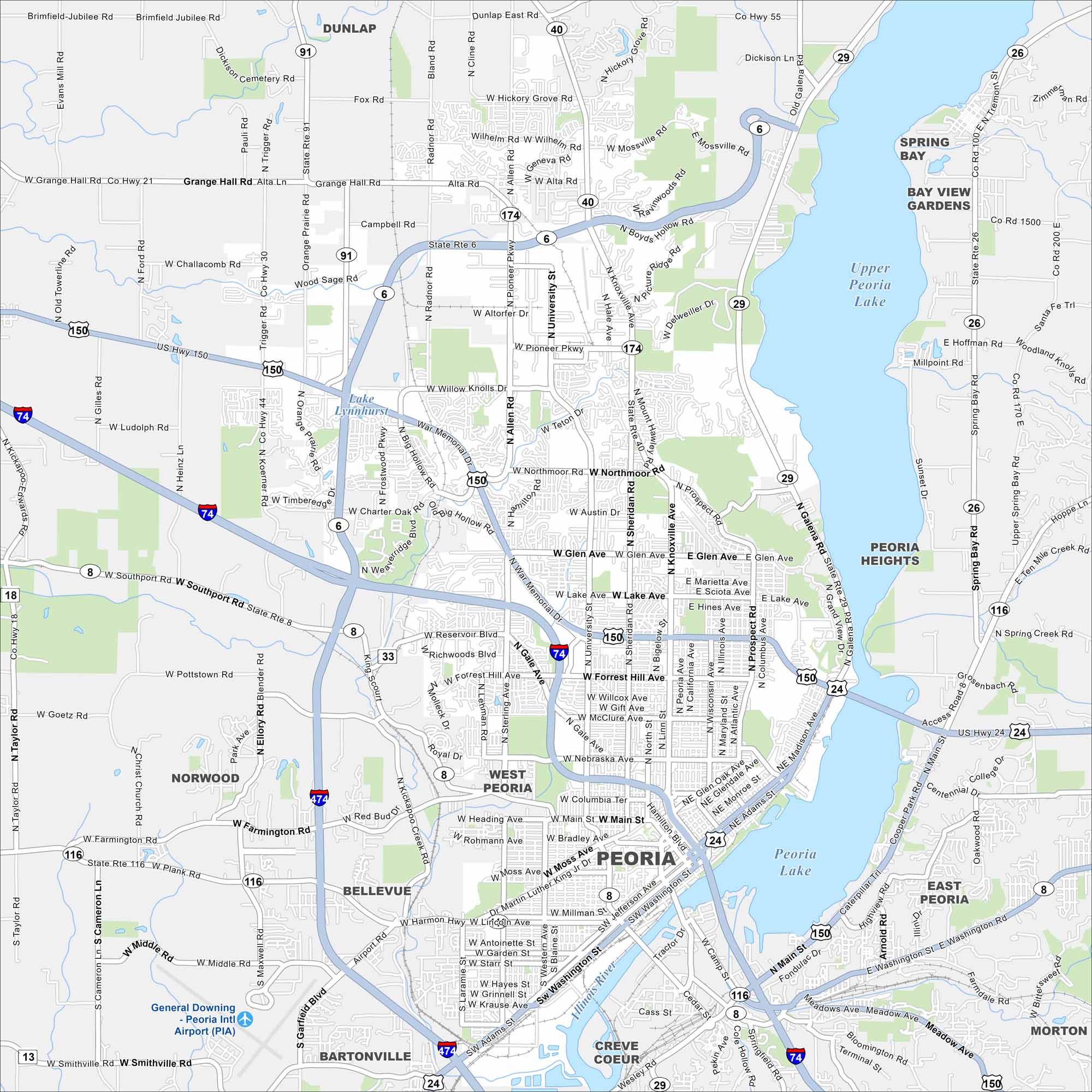
Peoria hugs the Illinois River in the center of the state. Our map highlights the riverfront, downtown streets, and surrounding neighborhoods. The city is a hub for business, culture, and industry.
Illinois State Maps
Get to know Illinois with our state maps


Map Information
On the Map
Interstates/Highways: I-74, I-474, US Hwy 150, US Hwy 24, State Rte 91, State Rte 6, State Rte 40, State Rte 8, State Rte 33, State Rte 116, State Rte 29 Major Roads: War Memorial Dr, University St, Knoxville Ave, Glen Ave, Main St, Washington St, Adams St, Jefferson Ave, Pioneer Pkwy, Allen Rd, Sterling Ave, Western Ave, Farmington Rd, Grand View Dr, Galena Rd, Nebraska Ave, Forest Hill Ave, Lake Ave, Willow Knolls Dr, Charter Oak Rd Airports: Peoria Intl Airport (PIA) Lakes and Reservoirs: Lake Lynnhurst, Upper Peoria Lake, Peoria Lake Major Rivers: Illinois River Nearby Communities: Dunlap, Spring Bay, Bay View Gardens, Peoria Heights, West Peoria, Norwood, Bellevue, Bartonville, Creve Coeur, East Peoria, MortonIllinois City Maps
Explore Chicago and urban regions of Illinois


