Pennsylvania Population Density Map
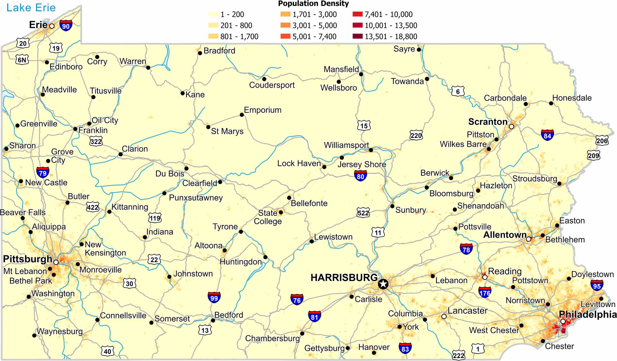
Population concentrates at the eastern and western ends of the state. The central mountains show much lower density. Also, forested ridges limit development.
Map Information
Pennsylvania State Maps
Browse maps throughout the Keystone State.


City Maps of Pennsylvania
Here is our city map collection for all of Pennsylvania.


