Map of Park Ridge, Illinois
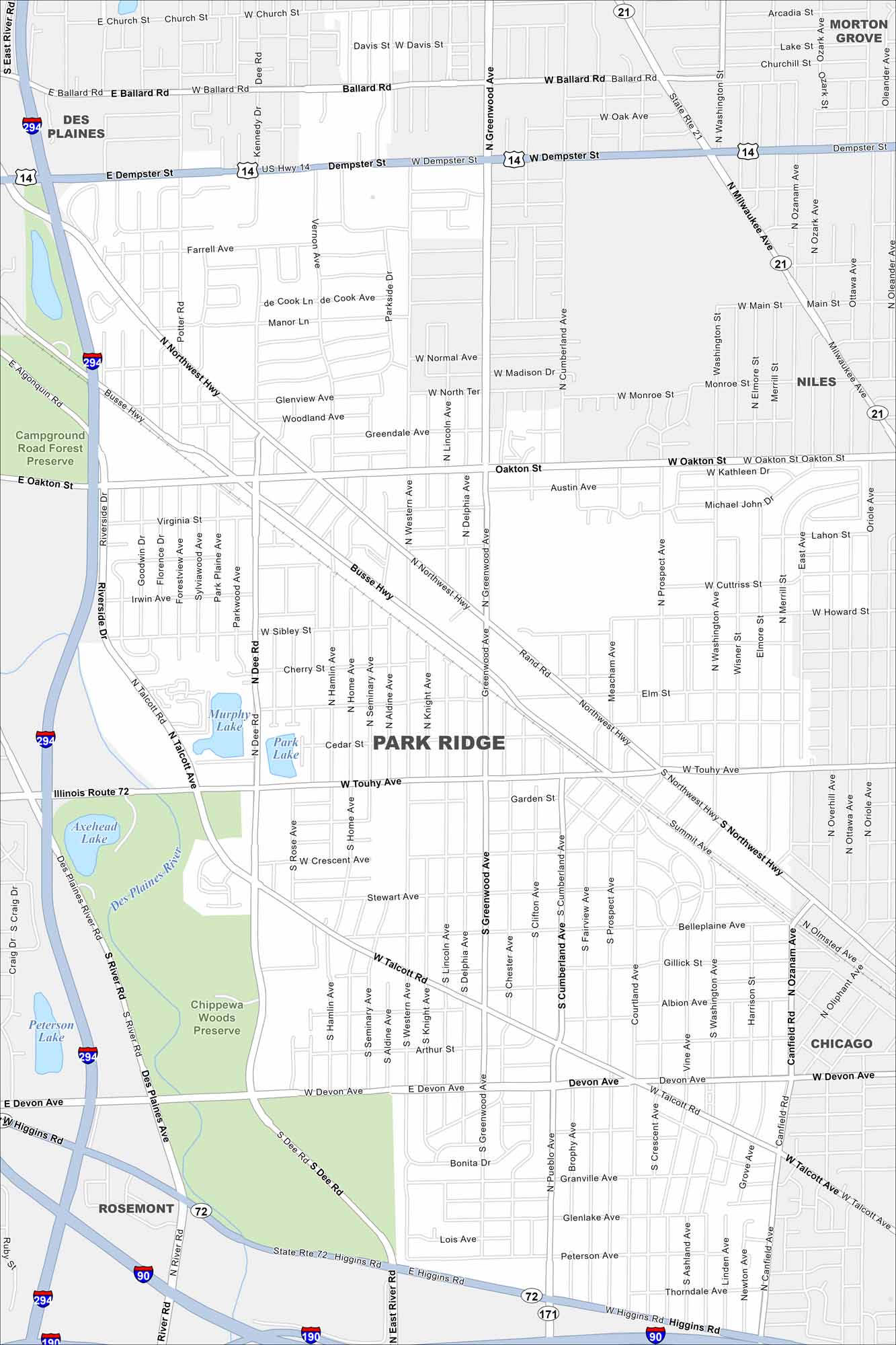
Check out Park Ridge just northwest of Chicago. This map shows leafy neighborhoods and a classic downtown core. The city grew up as a suburban community tied closely to the big city.
Illinois State Maps
Get to know Illinois with our state maps


Map Information
On the Map
Interstates/Highways: I-294, I-190, I-90, US Hwy 14, State Rte 72, State Rte 21, Northwest Hwy Major Roads: Dempster St, Touhy Ave, Devon Ave, Talcott Rd, Higgins Rd, Greenwood Ave, Oakton St, Cumberland Ave, Milwaukee Ave, Ballard Rd, Busse Hwy, Dee Rd, Potter Rd, Western Ave, Canfield Rd, Ozanam Ave, Main St, Washington St, Riverside Dr Lakes and Reservoirs: Murphy Lake, Park Lake, Axehead Lake, Peterson Lake Major Rivers: Des Plaines River Parks and Preserves: Campground Road Forest Preserve, Chippewa Woods Preserve Nearby Communities: Des Plaines, Morton Grove, Niles, Chicago, RosemontIllinois City Maps
Explore Chicago and urban regions of Illinois


