Map of Overland, Missouri
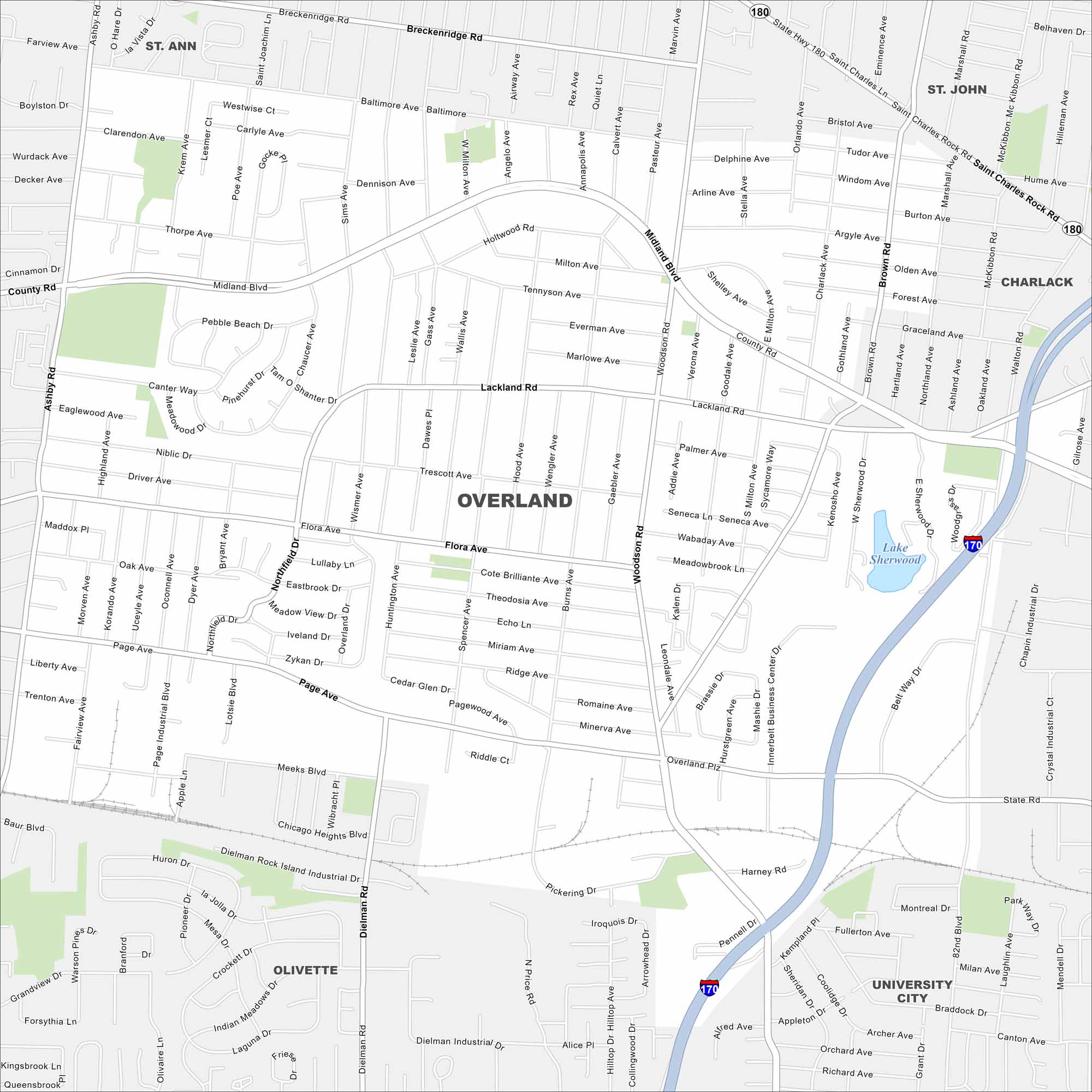
Check out Overland just west of St. Louis. This map highlights residential neighborhoods, parks, and busy roadways. It’s a compact community with close ties to the metro area.
Map Information
On the Map
Interstates/Highways: I-170, State Hwy 180 Major Roads: Page Ave, Midland Blvd, Lackland Rd, Woodson Rd, Flora Ave, Ashby Rd, Dielman Rd, Lindbergh Blvd, Saint Charles Rock Rd, Northfield Dr, Innerbelt Business Center Dr, Brown Rd, Northland Ave, Adie Rd, Warson Rd, Baur Blvd Lakes and Reservoirs: Lake Sherwood Nearby Communities: St. Ann, St. John, Charlack, University City, OlivetteMissouri State Maps
Check out state maps of the Show-Me State.


Missouri City Maps
Here are our city maps for Missouri


