Map of Orland Park, Illinois
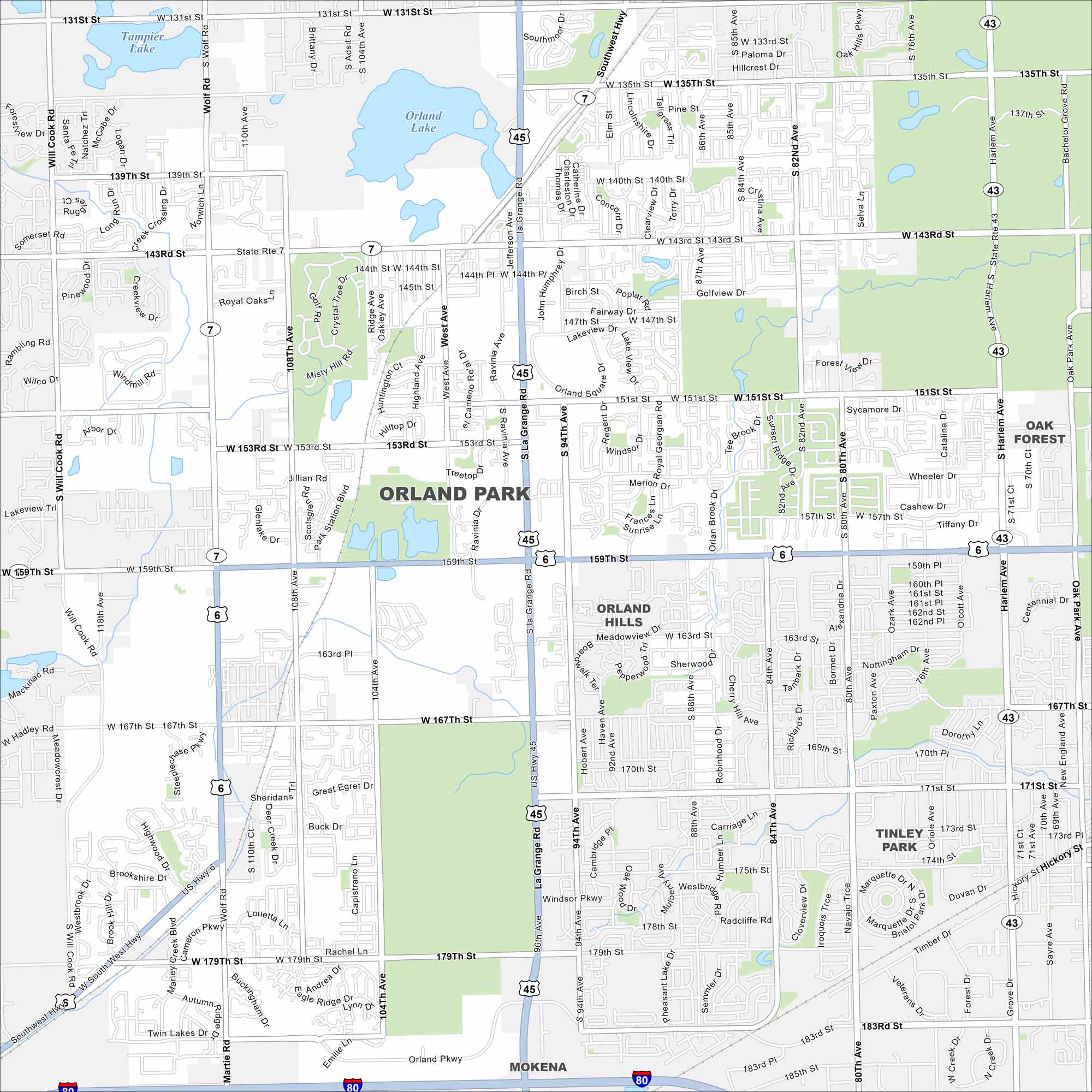
Here’s our map of Orland Park in southwest of Chicago. This map shows suburban lakes, rivers, highways, and parks. Trails and forest preserves surround much of the community.
Illinois State Maps
Get to know Illinois with our state maps


Map Information
On the Map
Interstates/Highways: I-80, US Hwy 45, US Hwy 6, State Rte 43, State Rte 7 Major Roads: La Grange Rd, 159th St, 143rd St, 151st St, 167th St, 179th St, 183rd St, Harlem Ave, 104th Ave, 108th Ave, 80th Ave, Wolf Rd, Will Cook Rd, Southwest Hwy, Orland Pkwy, Ravinia Ave, West Ave, 94th Ave, 82nd Ave, 76th Ave Lakes and Reservoirs: Tampier Lake, Orland Lake Nearby Communities: Orland Hills, Tinley Park, Mokena, Oak ForestIllinois City Maps
Explore Chicago and urban regions of Illinois


