Map of Orem, Utah
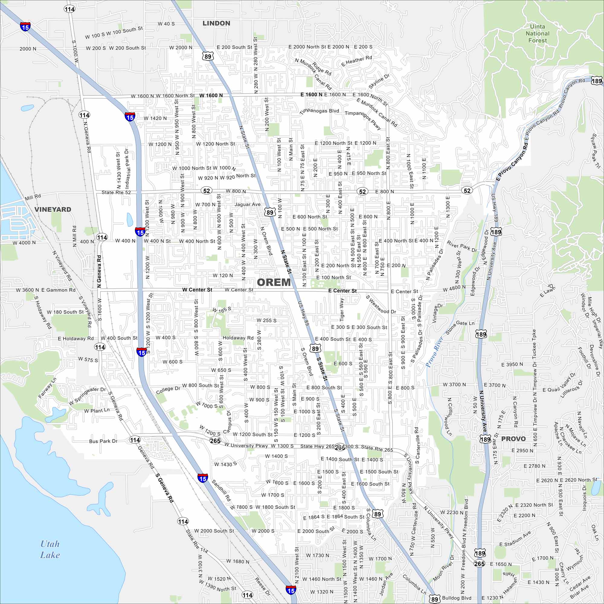
Our map of Orem highlights a city stretched along Utah Valley. Mountains rise immediately to the east, framing neighborhoods and campuses. Utah Lake sits just a short drive to the west (as shown in our map).
Map Information
On the Map
Interstates/Highways: I-15, US Hwy 89, US Hwy 189, State Rte 114, State Rte 52, State Rte 265 Major Roads: State St, Geneva Rd, University Pkwy, Center St, 800 North St, 1600 North St, 400 North St, 400 South St, 800 South St, 1200 South St, 2000 North St, 1200 West St, 800 West St, 400 West St, Main St, 400 East St, 800 East St, University Ave, Industrial Park Dr, Sandhill Rd Lakes and Reservoirs: Utah Lake Major Rivers: Provo River Parks and Preserves: Uinta National Forest Nearby Communities: Lindon, Vineyard, ProvoUtah State Maps
Look through maps of deserts, parks, and cities.


City Maps of Utah
Here is Salt Lake City and Utah’s urban regions.


