Oregon Biomes Map
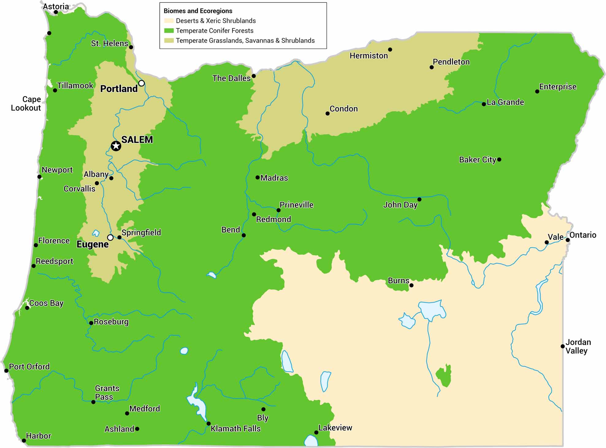
Our Oregon biomes map shows wet coastal forests, dry interior basins, and forests/shrubland. It’s one state that has very different environments. The Cascade Range acts as a clear dividing line.
Map Information
On the Map
Our table below displays the biome area and percent for Oregon.|
Biome |
Area (Square Miles) |
Percent |
|
Deserts & Xeric Shrublands |
23843 |
24.6 |
|
Temperate Conifer Forests |
60923 |
62.9 |
|
Temperate Grasslands, Savannas & Shrublands |
12164 |
12.5 |
|
Ecoregion |
Area (Square Miles) |
Percent |
|
Blue Mountains forests |
23916 |
24.7 |
|
Central Pacific Northwest coastal forests |
8989 |
9.3 |
|
Central-Southern Cascades Forests |
11215 |
11.6 |
|
Eastern Cascades forests |
10585 |
10.9 |
|
Great Basin montane forests |
103 |
0.1 |
|
Klamath-Siskiyou forests |
6015 |
6.2 |
|
Northern California coastal forests |
99 |
0.1 |
|
Palouse prairie |
6830 |
7.0 |
|
Puget lowland forests |
1 |
0.0 |
|
Snake-Columbia shrub steppe |
23843 |
24.6 |
|
Willamette Valley oak savanna |
5334 |
5.5 |
Oregon State Maps
Here is our state map collection of Oregon.


