Map of O’Fallon, Missouri
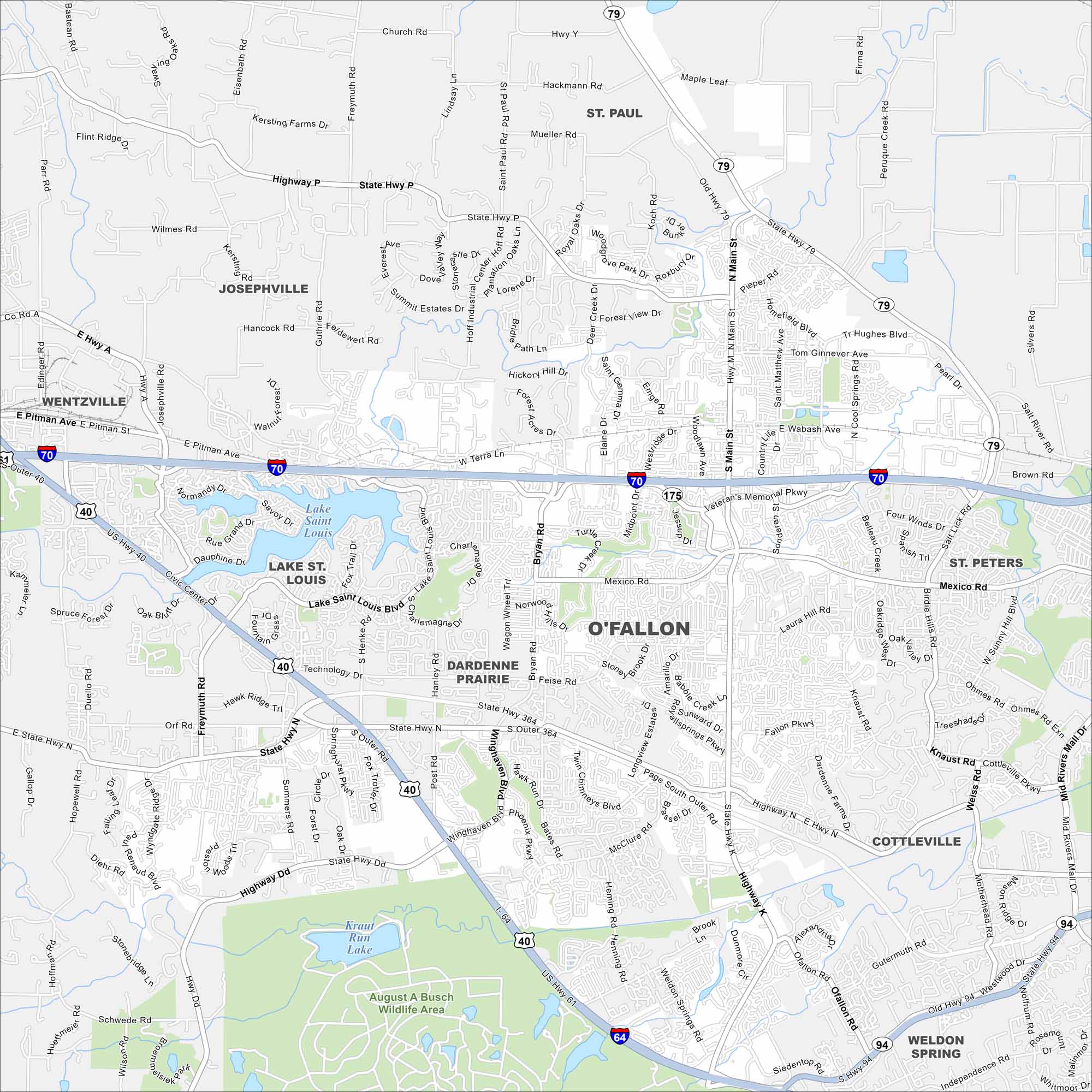
O’Fallon sits west of St. Louis in St. Charles County. Our map shows residential areas, parks, and highways crossing through. It’s actually one of the fastest-growing cities in the region.
Map Information
On the Map
Interstates/Highways: I-70, I-64, US Hwy 40, US Hwy 61, State Hwy 364, State Hwy 79 Major Roads: Main St, Mexico Rd, Bryan Rd, Feise Rd, Tom Ginnever Ave, TR Hughes Blvd, Mid Rivers Mall Dr, Lake Saint Louis Blvd, Wyndgate Ridge Dr, Diehr Rd, Gutermuth Rd, Westwood Dr, Pitman Ave, Terra Ln, Woodlawn Ave, Sonderen St, Belleau Creek Rd, Knaust Rd, Mexico Rd Lakes and Reservoirs: Lake Saint Louis, Kraut Run Lake Parks and Preserves: August A Busch Wildlife Area Nearby Communities: Saint Paul, Josephville, Wentzville, Lake St. Louis, Dardenne Prairie, St. Peters, Cottleville, Weldon SpringMissouri State Maps
Check out state maps of the Show-Me State.


Missouri City Maps
Here are our city maps for Missouri


