Map of Oak Lawn, Illinois
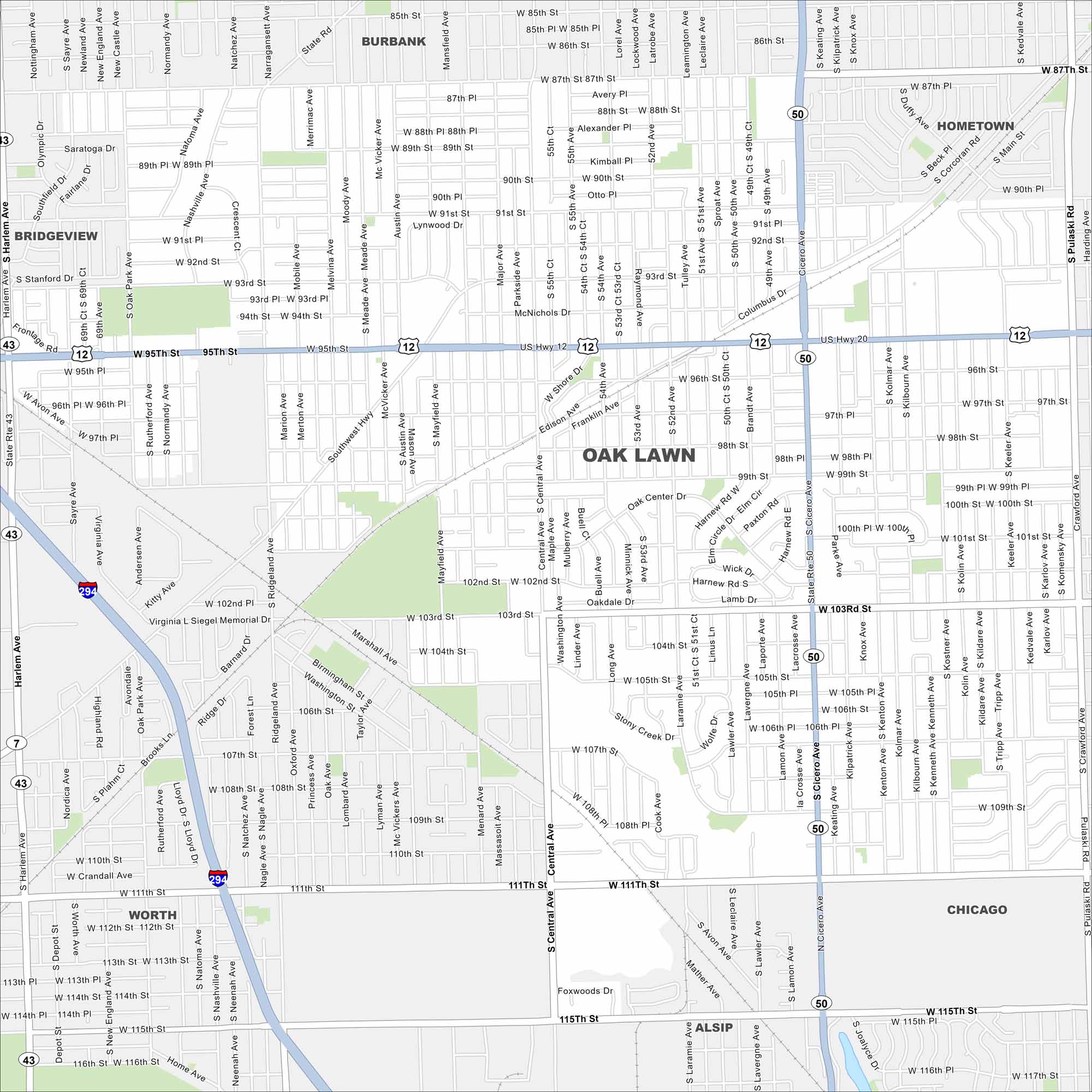
Oak Lawn sits southwest of Chicago. Take a look at this map to see its suburban grid, railways, and highway connections. It’s one of the larger suburbs in Cook County.
Illinois State Maps
Get to know Illinois with our state maps


Map Information
On the Map
Interstates/Highways: I-294, US Hwy 12, US Hwy 20, State Rte 50, State Rte 43, State Rte 7 Major Roads: 95th St, Cicero Ave, 87th St, 103rd St, 111th St, Harlem Ave, Central Ave, Pulaski Rd, Southwest Hwy, Columbus Dr, Ridgeland Ave, Narragansett Ave, 79th St, State Rd, Keeler Ave, Kilbourn Ave, Kedzie Ave, Crawford Ave, Southworth Hwy, Roberts Rd Nearby Communities: Burbank, Hometown, Chicago, Alsip, Worth, BridgeviewIllinois City Maps
Explore Chicago and urban regions of Illinois


