Map of North Chicago, Illinois
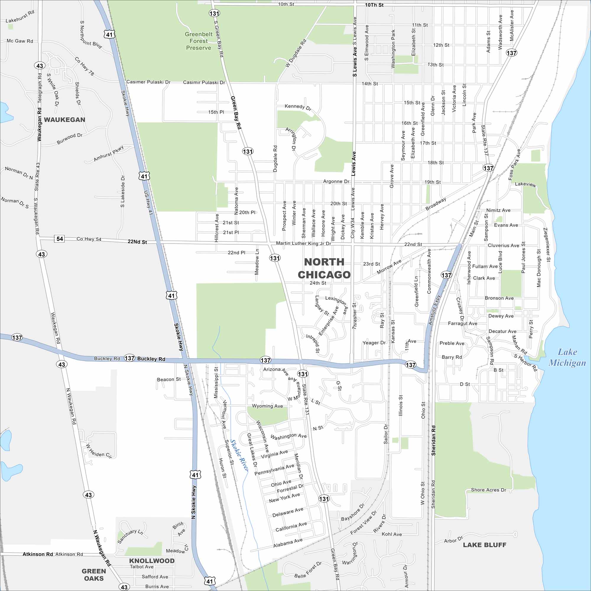
North Chicago sits on Lake Michigan between Waukegan and Lake Bluff. Our map highlights a compact street grid and highway system. This is a key hub in Lake County.
Illinois State Maps
Get to know Illinois with our state maps


Map Information
On the Map
Interstates/Highways: US Hwy 41, State Rte 137, State Rte 131, State Rte 43, Skokie Hwy Major Roads: Buckley Rd, Sheridan Rd, Martin Luther King Jr Dr, 22nd St, 24th St, 14th St, 10th St, Argonne Dr, Broadway, Lewis Ave, Green Bay Rd, Waukegan Rd, Amstutz Expy, Morrow Ave, Casimer Pulaski Dr, Dugdale Rd, Foss Park Ave, Commonwealth Ave, Jackson St Lakes and Reservoirs: Lake Michigan Major Rivers: Skokie River Parks and Preserves: Greenbelt Forest Preserve Nearby Communities: Waukegan, Lake Bluff, Knollwood, Green OaksIllinois City Maps
Explore Chicago and urban regions of Illinois


