Home » State Maps » Satellite Map of North Carolina

Satellite Map of North Carolina

North Carolina Satellite Map

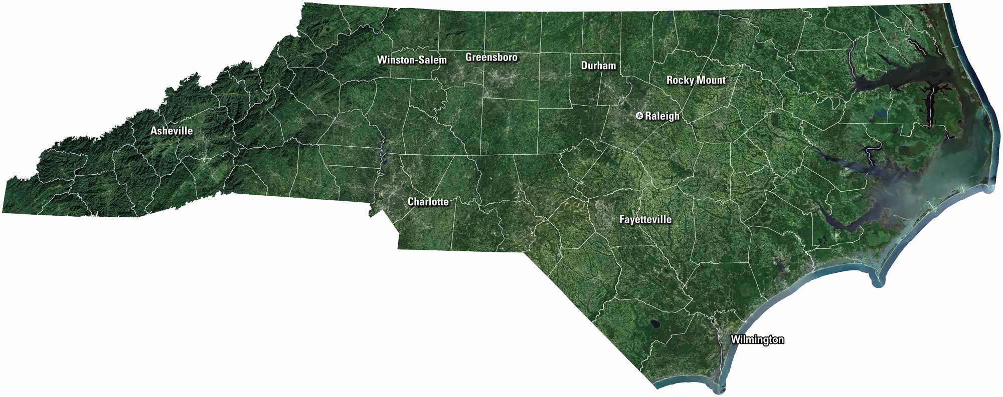
Our satellite map of North Carolina shows rivers, forests, and long stretches of farmland. Mountains roll in the west, while the coast opens wide to the Atlantic. Charlotte and Raleigh mark the busy centers, but small towns fill the spaces between. North Carolina is often called the Tar Heel State for its history and pride.

Map Information

  • State of North Carolina
  • Satellite Map of North Carolina with Landsat-8 Imagery
  • Free for personal and commercial purpose. Attribution is required. How to attribute?

On the Map

North Carolina Location Map
Cities/Towns (Labels): Asheville, Winston-Salem, Greensboro, Durham, Raleigh, Rocky Mount, Charlotte, Fayetteville, Wilmington Mountain Ranges: Blue Ridge Mountains, Great Smoky Mountains Lakes/Reservoirs: Lake Norman, Lake Gaston, Kerr Lake, B. Everett Jordan Lake Major Rivers: Cape Fear River, Neuse River, Roanoke River, Yadkin River Coastal Features: Outer Banks, Pamlico Sound, Albemarle Sound

References

  1. NASA Worldview Earthdata
  2. USGS State Mosaics

Leave a Reply

Your email address will not be published. Required fields are marked *