Map of Newport News, Virginia
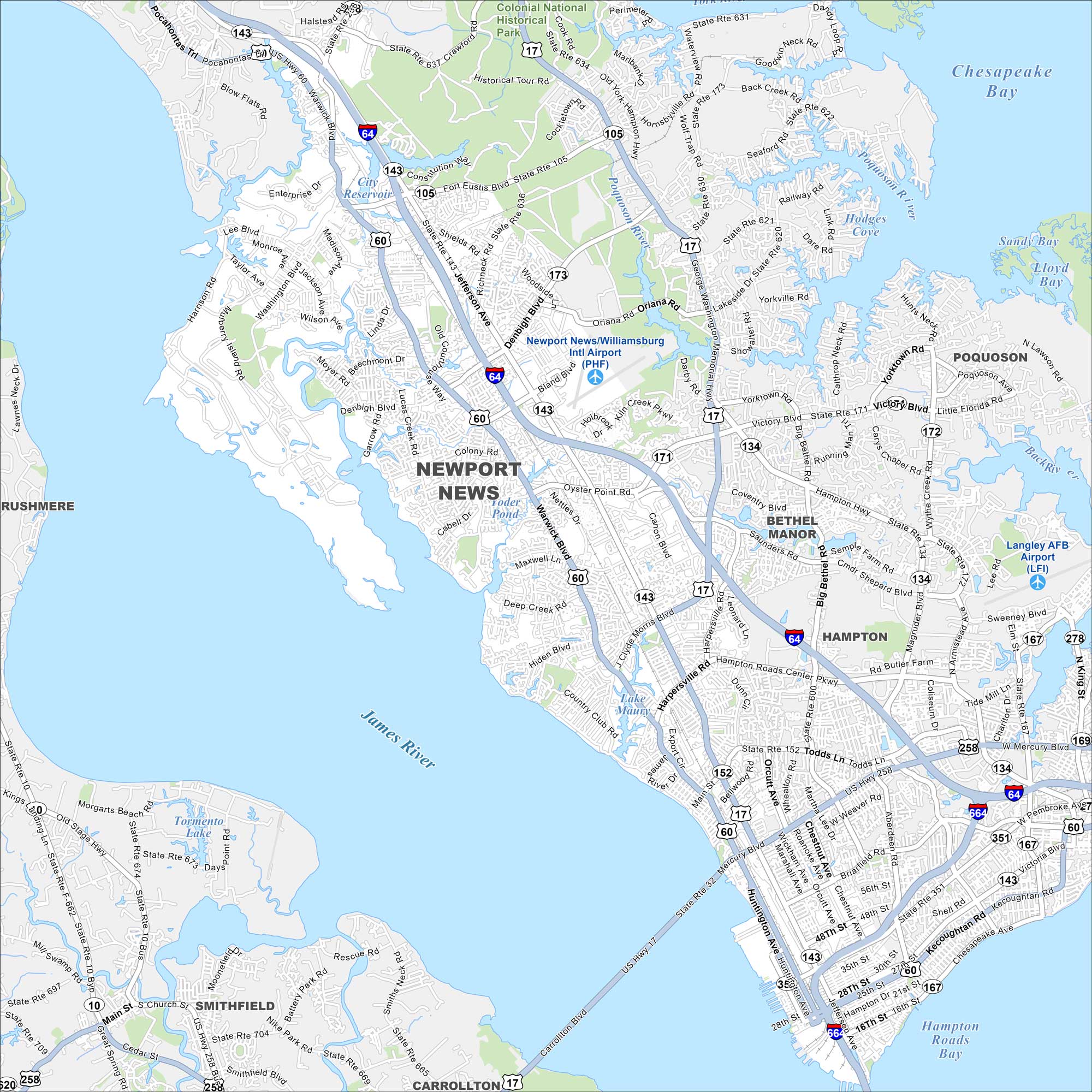
Our map of Newport News shows this Virginia city stretched along the James River. Shipyards dominate the waterfront, while neighborhoods extend inland. It’s a key part of the Hampton Roads region.
Map Information
On the Map
Interstates/Highways: I-64, I-664, US Hwy 17, US Hwy 60, US Hwy 258 Major Roads: Warwick Blvd, Jefferson Ave, Mercury Blvd, Denbigh Blvd, Oyster Point Rd, J Clyde Morris Blvd, Harpersville Rd, Main St, Victory Blvd, Fort Eustis Blvd, Yorktown Rd, Wythe Creek Rd, Magruder Blvd, Commander Shepard Blvd, Armistead Ave, Saunders Rd, Big Bethel Rd, Todds Ln, Aberdeen Rd, Pembroke Ave Airports: Newport News/Williamsburg Intl Airport (PHF), Langley AFB Airport (LFI) Lakes and Reservoirs: City Reservoir, Foder Pond, Lake Maury, Tormento Lake, Hampton Roads Bay, Chesapeake Bay Major Rivers: Poquoson River, James River Parks and Preserves: Colonial National Historical Park Nearby Communities: Poquoson, Bethel Manor, Hampton, Smithfield, Carrollton, RushmereVirginia State Maps
Spanning coasts and mountains, here are our maps of Virginia.


City Maps of Virginia
Traverse Virginia using our city maps


