Home » State Maps » Satellite Map of New Jersey

Satellite Map of New Jersey

New Jersey Satellite Map

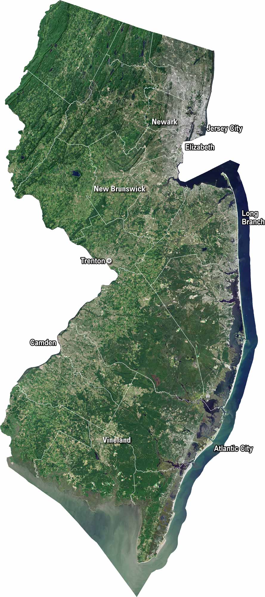
Our satellite map shows New Jersey’s dense cities and winding shorelines. We’ve clearly marked Trenton, Newark, and Jersey City. The Delaware River runs along its western border. New Jersey is known for its mix of urban centers and coastal borders.

Map Information

  • State of New Jersey
  • Satellite Map of New Jersey with Landsat-8 Imagery
  • Free for personal and commercial purpose. Attribution is required. How to attribute?

On the Map

New Jersey Location Map
Cities/Towns (Labels): Atlantic City, Camden, Elizabeth, Jersey City, Long Branch, New Brunswick, Newark, Trenton, Vineland Geographic Regions: Pine Barrens (Large forested area in the South), The Highlands (Northwest) Major Rivers: Delaware River (Western border), Hudson River (Northeast border) Water Bodies: Delaware Bay (Southwest), Raritan Bay (Central coast)

References

  1. NASA Worldview Earthdata
  2. USGS State Mosaics

Leave a Reply

Your email address will not be published. Required fields are marked *