Map of Naperville, Illinois
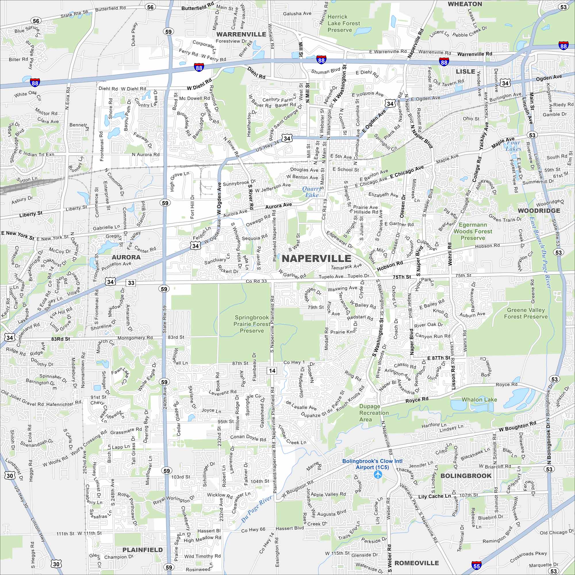
Our map of Naperville highlights a large suburb west of Chicago. The Riverwalk threads through downtown, while subdivisions and parks stretch far outward. It’s one of the largest cities in Illinois.
Illinois State Maps
Get to know Illinois with our state maps


Map Information
On the Map
Interstates/Highways: I-88, US Hwy 34, State Rte 59, State Rte 56, State Rte 53, State Rte 30 Major Roads: Ogden Ave, Aurora Ave, 75th St, 87th St, 95th St, 103rd St, 111th St, Washington St, Naper Blvd, Diehl Rd, Weber Rd, Plainfield Rd, Naperville Rd, Modaff Rd, Mill St, Main St, Book Rd, Eola Rd, Frontenac Rd, Loomis St Airports: Bolingbrook’s Clow Intl Airport (1C5) Lakes and Reservoirs: Quarry Lake, Whalon Lake Major Rivers: DuPage River, East Branch DuPage River Parks and Preserves: Herrick Lake Forest Preserve, Egermann Woods Forest Preserve, Springbrook Prairie Forest Preserve, Greene Valley Forest Preserve, DuPage Recreation Area Nearby Communities: Warrenville, Wheaton, Lisle, Woodridge, Aurora, Bolingbrook, Plainfield, RomeovilleIllinois City Maps
Explore Chicago and urban regions of Illinois


