Map of Mount Prospect, Illinois
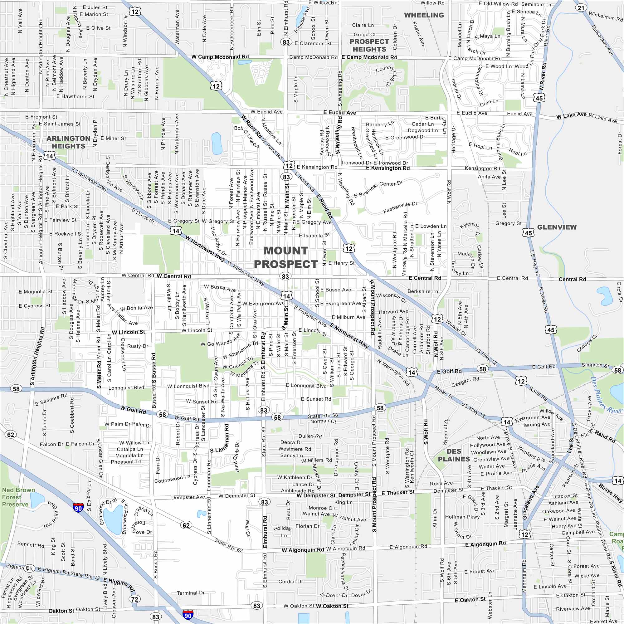
Explore Mount Prospect with our map. It’s one of the larger Chicago suburbs. You’ll notice its access to major highways. It’s a classic commuter hub with a large shopping corridor.
Illinois State Maps
Get to know Illinois with our state maps


Map Information
On the Map
Interstates/Highways: I-90, US Hwy 12, US Hwy 14, US Hwy 45, State Rte 83, State Rte 58, State Rte 62, State Rte 72, State Rte 21, Northwest Hwy Major Roads: Central Rd, Golf Rd, Algonquin Rd, Oakton St, Main St, Elmhurst Rd, Wolf Rd, Mount Prospect Rd, Busse Rd, Arlington Heights Rd, Euclid Ave, Kensington Rd, Camp McDonald Rd, Wheeling Rd, River Rd, Dempster St, Higgins Rd, Rand Rd, Wille Rd Major Rivers: Des Plaines River Parks and Preserves: Ned Brown Forest Preserve Nearby Communities: Prospect Heights, Wheeling, Glenview, Des Plaines, Arlington HeightsIllinois City Maps
Explore Chicago and urban regions of Illinois


