Home » State Maps » Satellite Map of Mississippi

Satellite Map of Mississippi

Mississippi Satellite Map

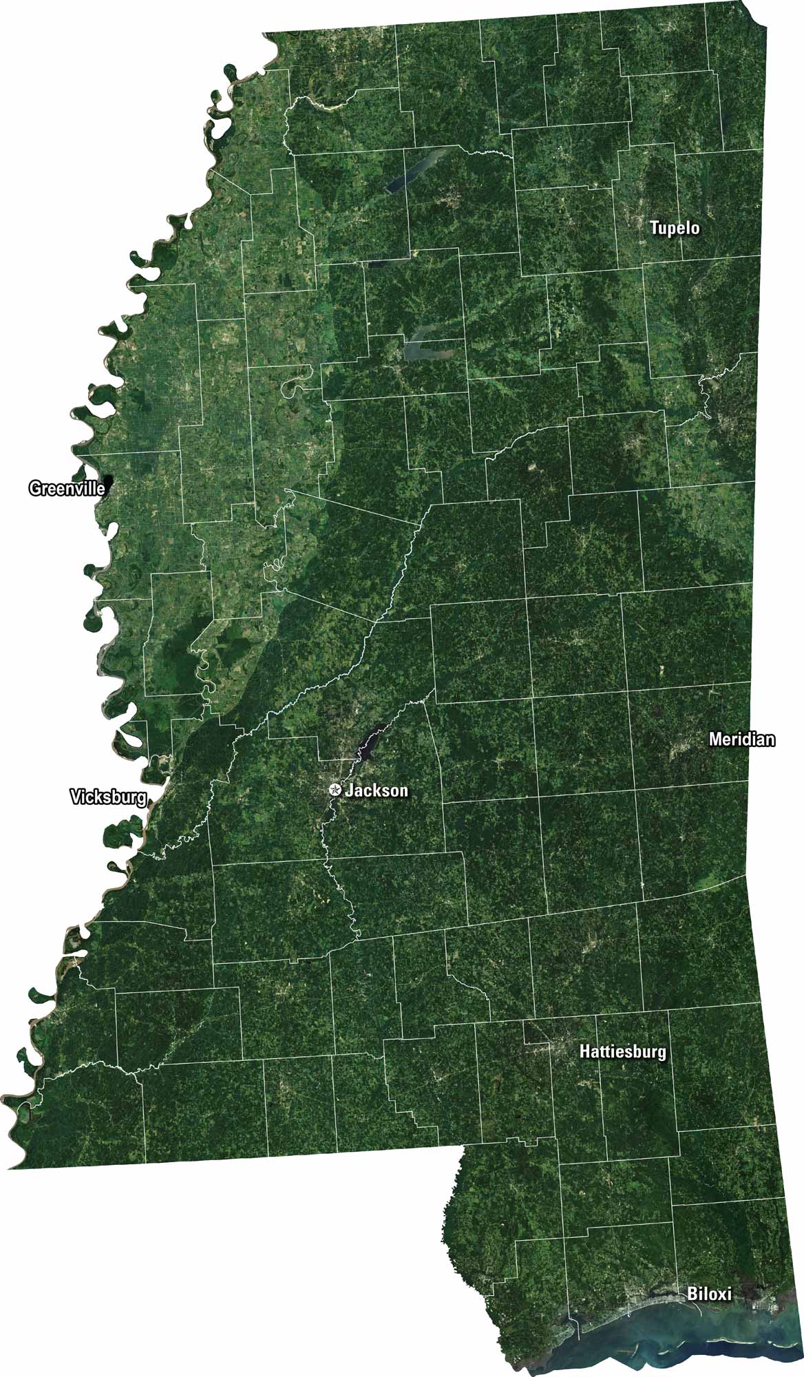
Our Mississippi satellite map shows its wide rivers and green farmland. Jackson is the capital here and really stands out on the map. The Mississippi River runs along its western edge. Wetlands and forests cover the landscape.

Map Information

  • State of Mississippi
  • Satellite Map of Mississippi with Landsat-8 Imagery
  • Free for personal and commercial purpose. Attribution is required. How to attribute?

On the Map

Mississippi Location Map
Cities/Towns (Labels): Biloxi, Greenville, Hattiesburg, Jackson, Meridian, Tupelo, Vicksburg Major Rivers: Mississippi River (Western border), Yazoo River (Northwest interior) Lakes/Reservoirs: Ross Barnett Reservoir (Northeast of Jackson), Enid Lake (Northwest) National Forests: De Soto National Forest (Southeast), Delta National Forest (West)

References

  1. NASA Worldview Earthdata
  2. USGS State Mosaics

Leave a Reply

Your email address will not be published. Required fields are marked *