Home » State Maps » Mississippi Population Density Map

Mississippi Population Density Map

Mississippi Population Density Map

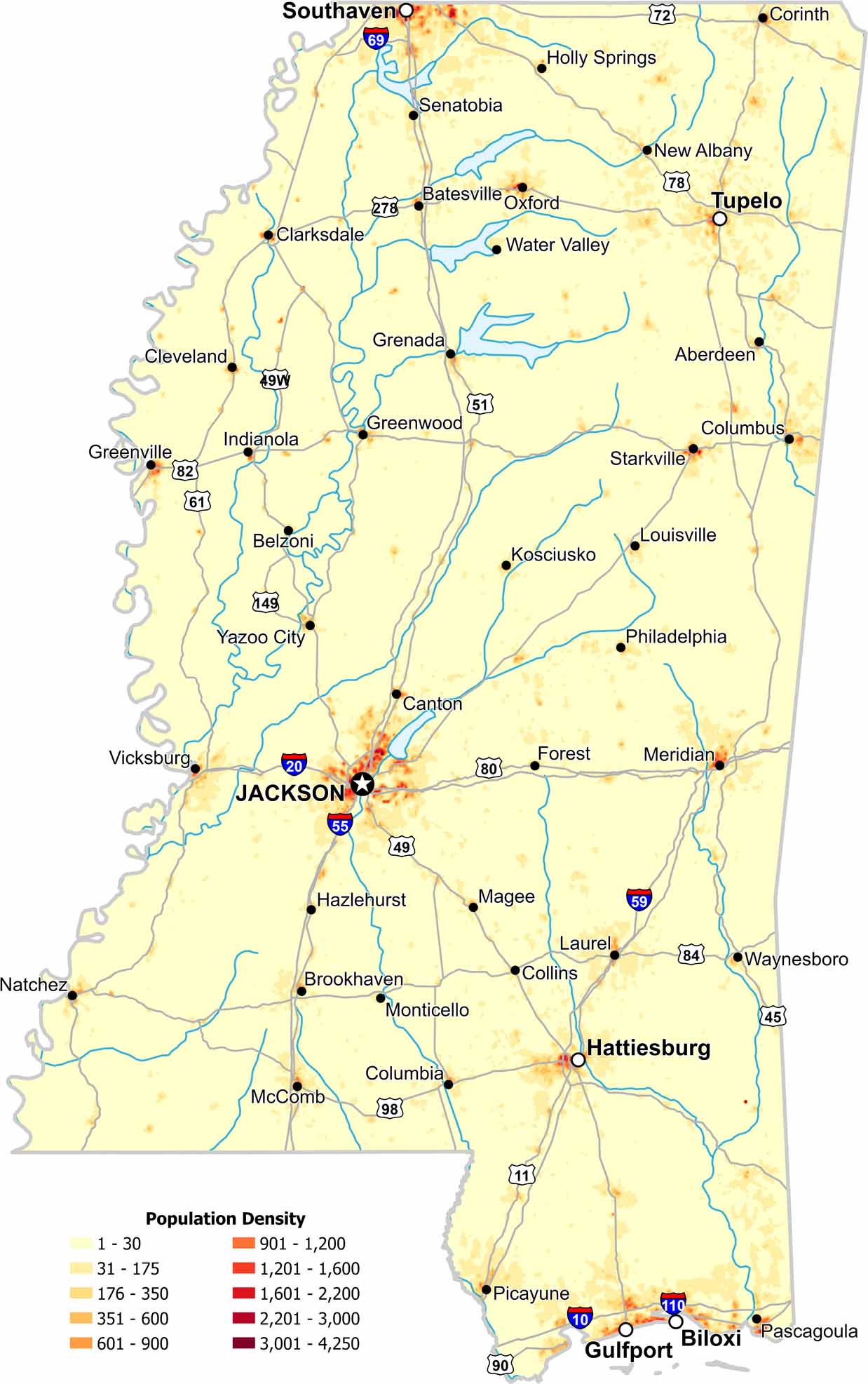
In Mississippi, population density increases near river corridors and major cities. Our map shows wide rural stretches with lighter population. Agriculture defines much of the landscape so it’s not blaring with red.

Map Information

  • Population Density Map of Mississippi
  • Data provided by NASA SEDAC Gridded Population of the World
  • Free for personal and commercial purpose. Attribution is required. How to attribute?

Leave a Reply

Your email address will not be published. Required fields are marked *