Map of Millcreek, Utah
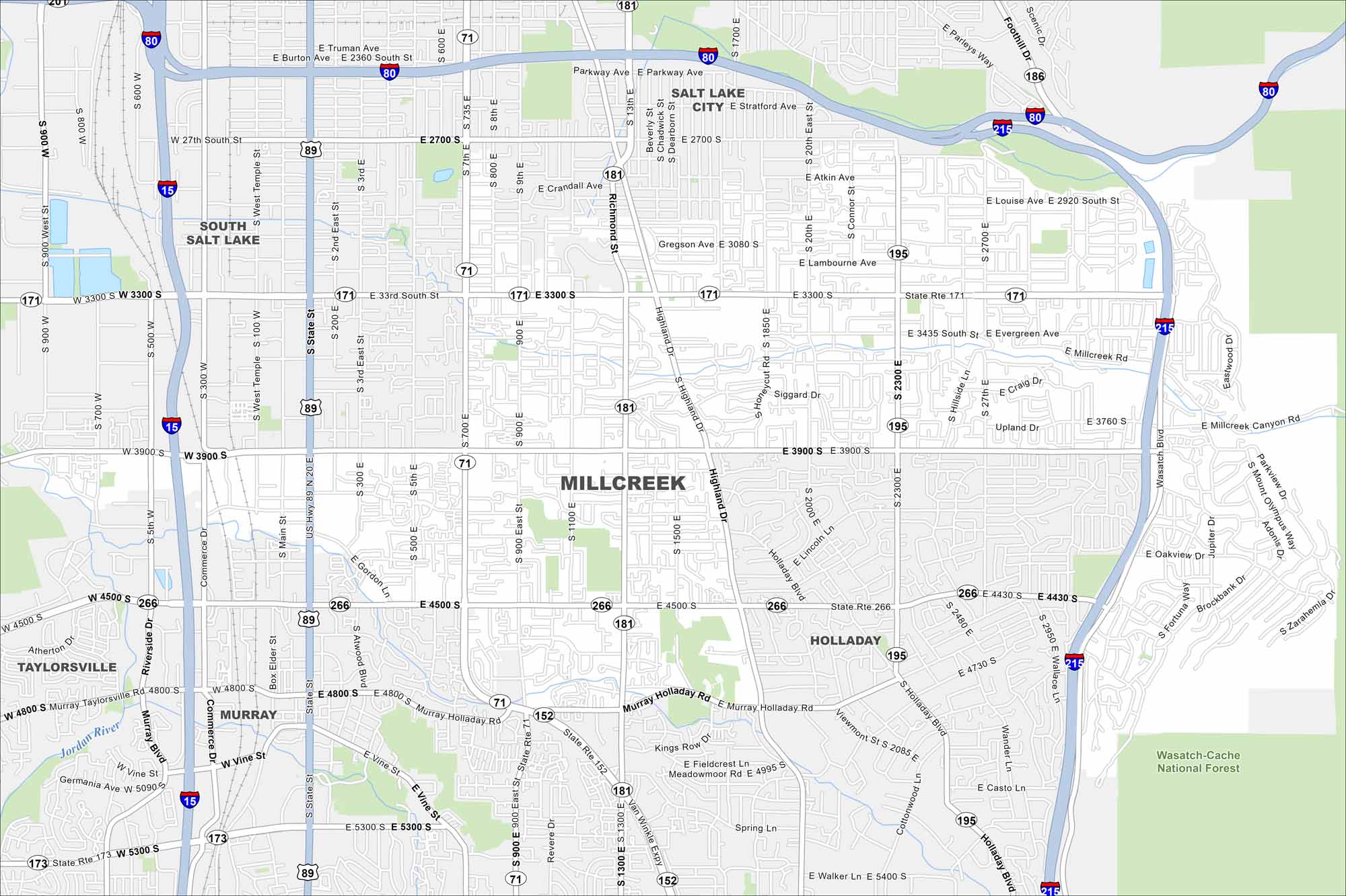
Take a look at our map of Millcreek, Utah. You can find it in the Salt Lake Valley so its outdoor access is a major draw here. Suburban neighborhoods spread at the base of the Wasatch Range.
Map Information
On the Map
Interstates/Highways: I-80, I-15, I-215, US Hwy 89, State Rte 181, State Rte 71, State Rte 171, State Rte 266, State Rte 195, State Rte 152, State Rte 186 Major Roads: State St, Highland Dr, 3300 South St, 3900 South St, 4500 South St, 900 East St, 700 East St, 1300 East St, 2300 East St, Wasatch Blvd, Main St, 500 East St, 2000 East St, 2700 South St, 2700 East St, 2100 East St, Millcreek Canyon Rd, Van Winkle Expy, Murray Holladay Rd, Foothill Dr Major Rivers: Jordan River Parks and Preserves: Wasatch-Cache National Forest Nearby Communities: Salt Lake City, South Salt Lake, Taylorsville, Murray, HolladayUtah State Maps
Look through maps of deserts, parks, and cities.


City Maps of Utah
Here is Salt Lake City and Utah’s urban regions.


