Michigan Population Density Map
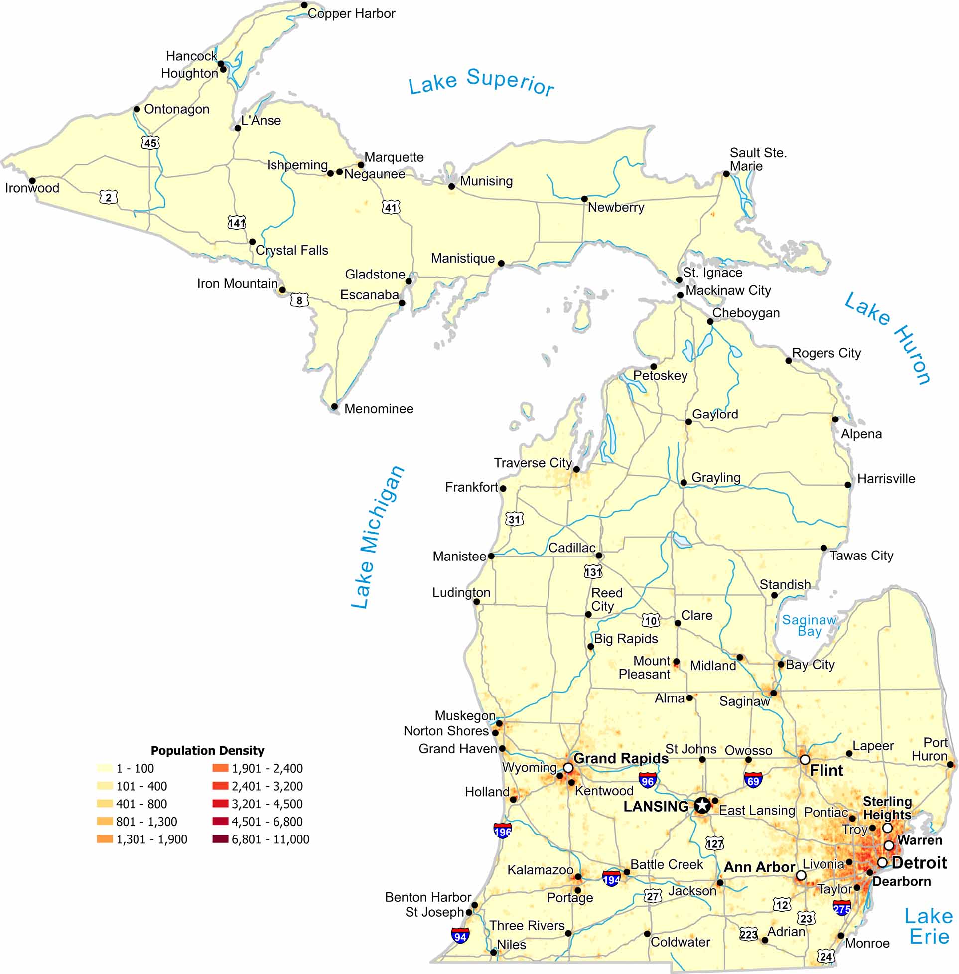
Our population density map of Michigan shows a sharp north–south contrast. Population clusters near Detroit and along lake shores. But the northern region is much more sparse in comparison.
Map Information
Our population density map of Michigan shows a sharp north–south contrast. Population clusters near Detroit and along lake shores. But the northern region is much more sparse in comparison.
Map Information